MyTopo
Hinckley Illinois US Topo Map
Couldn't load pickup availability
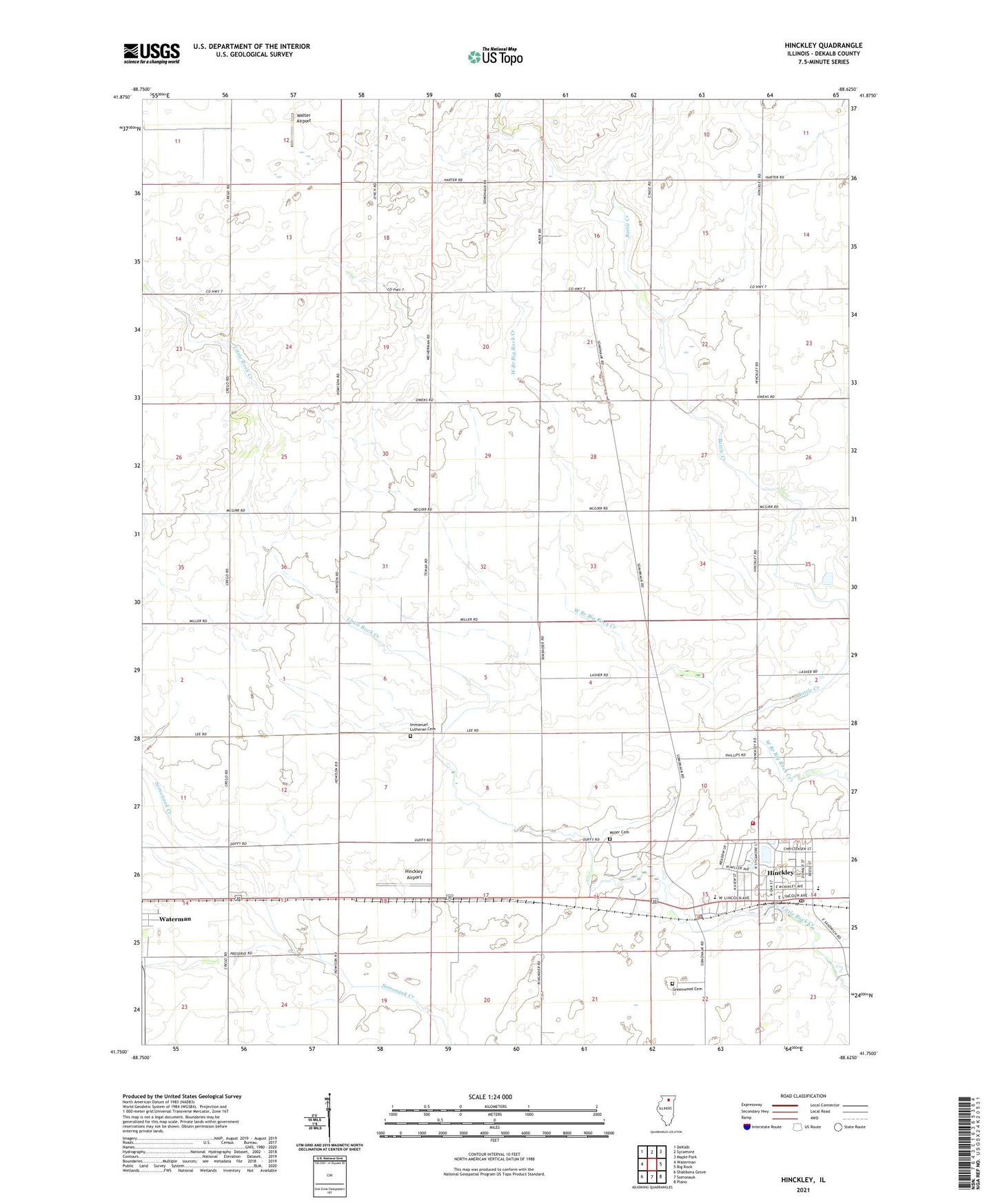
2024 topographic map quadrangle Hinckley in the state of Illinois. Scale: 1:24000. Based on the newly updated USGS 7.5' US Topo map series, this map is in the following counties: DeKalb. The map contains contour data, water features, and other items you are used to seeing on USGS maps, but also has updated roads and other features. This is the next generation of topographic maps. Printed on high-quality waterproof paper with UV fade-resistant inks.
Quads adjacent to this one:
West: Waterman
Northwest: DeKalb
North: Sycamore
Northeast: Maple Park
East: Big Rock
Southeast: Plano
South: Somonauk
Southwest: Shabbona Grove
This map covers the same area as the classic USGS quad with code o41088g6.
Contains the following named places: Ballek Landing Area, Battle Creek, Gallagher School, Granart School, Greenwood Cemetery, Hinckley, Hinckley Airport, Hinckley Elementary School, Hinckley Fire Protection District, Hinckley Police Department, Hinckley Post Office, Hinckley-Big Rock High School, Hipple School, Horan School, Immanuel Lutheran Cemetery, Immanuel Lutheran Church, Immanuel School, McGirr School, Miller Cemetery, Pierceville Post Office, Pioneer Park, Pooler School, Saint Pauls United Church of Christ, Swift School, Township of Pierce, Township of Squaw Grove, Village of Hinckley, Walter Airport, Ziegler School, ZIP Code: 60520