MyTopo
Somonauk Illinois US Topo Map
Couldn't load pickup availability
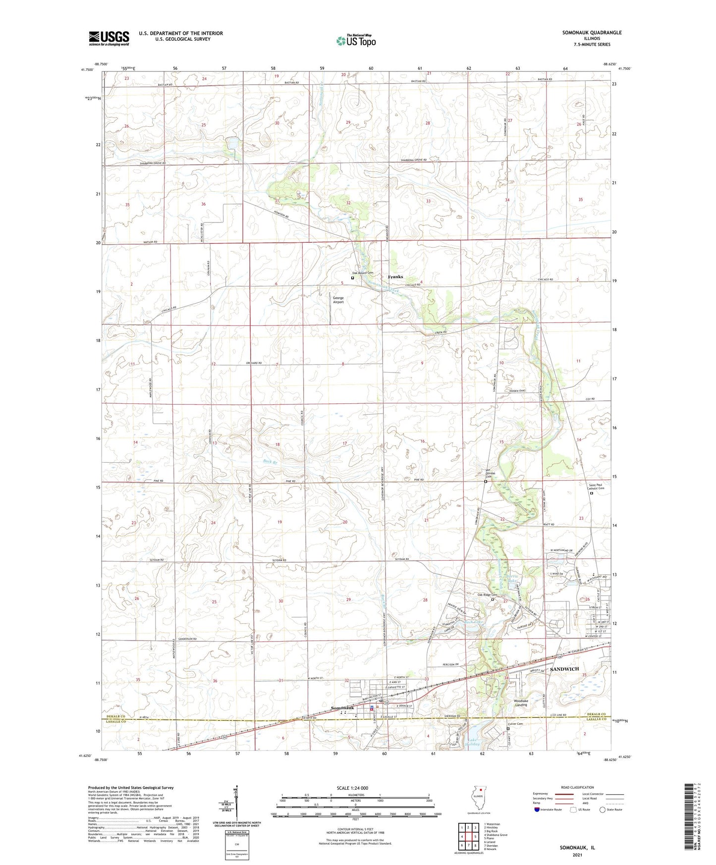
2024 topographic map quadrangle Somonauk in the state of Illinois. Scale: 1:24000. Based on the newly updated USGS 7.5' US Topo map series, this map is in the following counties: DeKalb, LaSalle. The map contains contour data, water features, and other items you are used to seeing on USGS maps, but also has updated roads and other features. This is the next generation of topographic maps. Printed on high-quality waterproof paper with UV fade-resistant inks.
Quads adjacent to this one:
West: Shabbona Grove
Northwest: Waterman
North: Hinckley
Northeast: Big Rock
East: Plano
Southeast: Newark
South: Sheridan
Southwest: Leland
This map covers the same area as the classic USGS quad with code o41088f6.
Contains the following named places: Binder School, Brookside School, Buck Branch, Buck Lake, Buck Lake Dam, Coleman School, Culver Cemetery, Edgebrook Country Club, Fay School, Franks, Freeland School, George Airport, Hays School, Oak Mound Cemetery, Oak Ridge Cemetery, Parris Lake, Prairie View Elementary School, Saint Paul Catholic Cemetery, Sandwich Airport, Sandwich Memorial Park, Saunnak Forest Preserve, Somonauk, Somonauk Church, Somonauk Community Fire Protection District, Somonauk Grade School, Somonauk Junior-Senior High School, Somonauk Police Department, Somonauk Post Office, Somonauk School, Sononauk Lake, Township of Sandwich, Township of Somonauk, Van Olindas Cemetery, Village of Somonauk, Warren Airport, Warren Landing Strip, Woodlake Landing, ZIP Codes: 60548, 60552