MyTopo
Bismarck Illinois US Topo Map
Couldn't load pickup availability
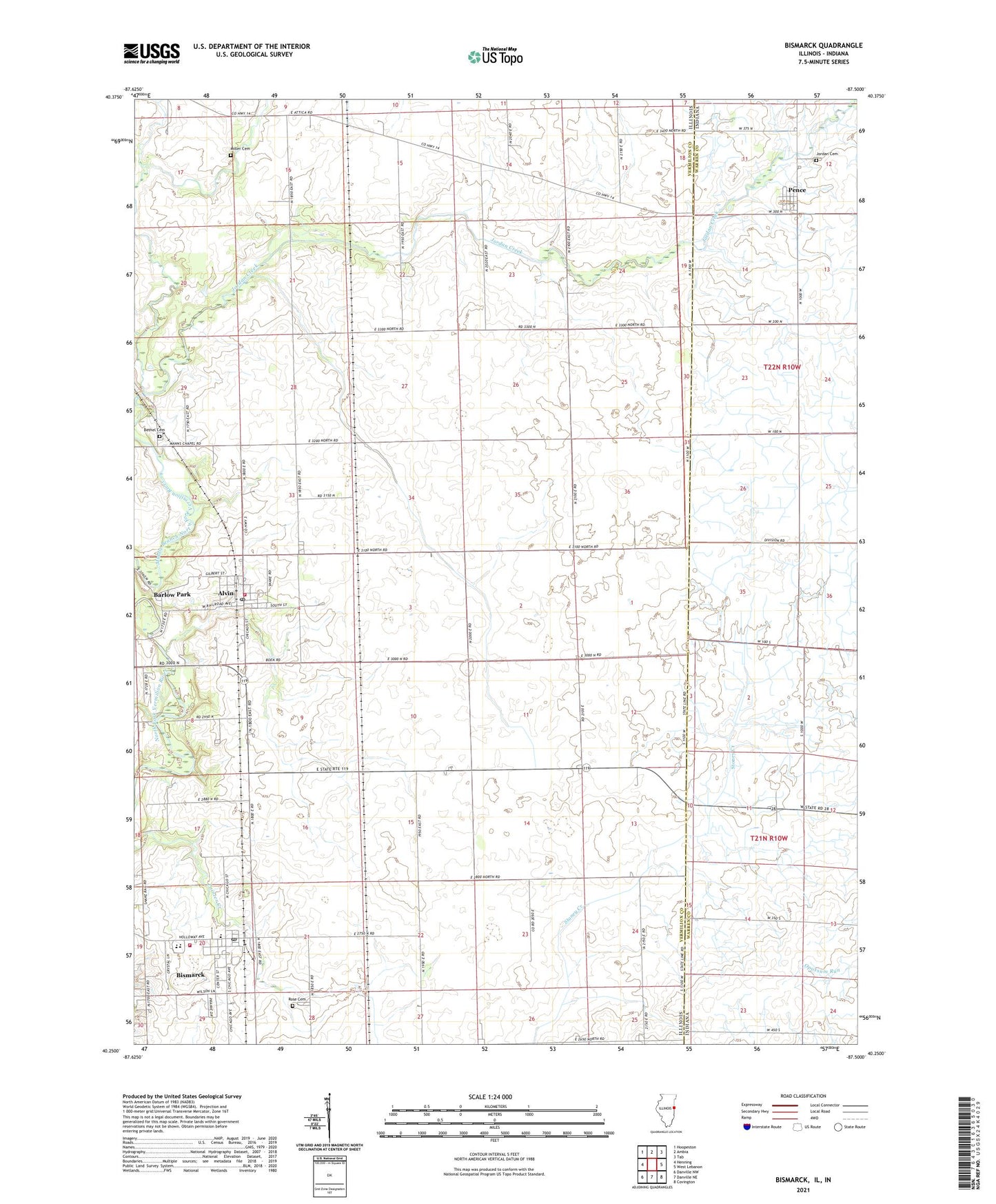
2024 topographic map quadrangle Bismarck in the states of Illinois, Indiana. Scale: 1:24000. Based on the newly updated USGS 7.5' US Topo map series, this map is in the following counties: Vermilion, Warren. The map contains contour data, water features, and other items you are used to seeing on USGS maps, but also has updated roads and other features. This is the next generation of topographic maps. Printed on high-quality waterproof paper with UV fade-resistant inks.
Quads adjacent to this one:
West: Henning
Northwest: Hoopeston
North: Ambia
Northeast: Tab
East: West Lebanon
Southeast: Covington
South: Danville NE
Southwest: Danville NW
Contains the following named places: Alvin Post Office, Barlow Park, Bethel Cemetery, Bethel School, Bismarck, Bismarck Community Ambulance, Bismarck Community Fire Protection District, Bismarck Elemenatary School, Bismarck Post Office, Bismarck United Methodist Church, Bismarck-Henning High School, Brown School, Cottage Grove School, Dale School, French School, Green School, James M Adams Airport, Johannot, Jordan Cemetery, Jordan Creek, Jordan Creek of the North Fork Nature Preserve, Knowles, Little Creek, Miller Cemetery, Pence, Pence Census Designated Place, Pleasant Hill School, Pleasant View School, Rose Cemetery, Sumner School, Thomas, Village of Alvan, Village of Alvan (Alvin), Village of Bismarck, ZIP Code: 61811