MyTopo
Henning Illinois US Topo Map
Couldn't load pickup availability
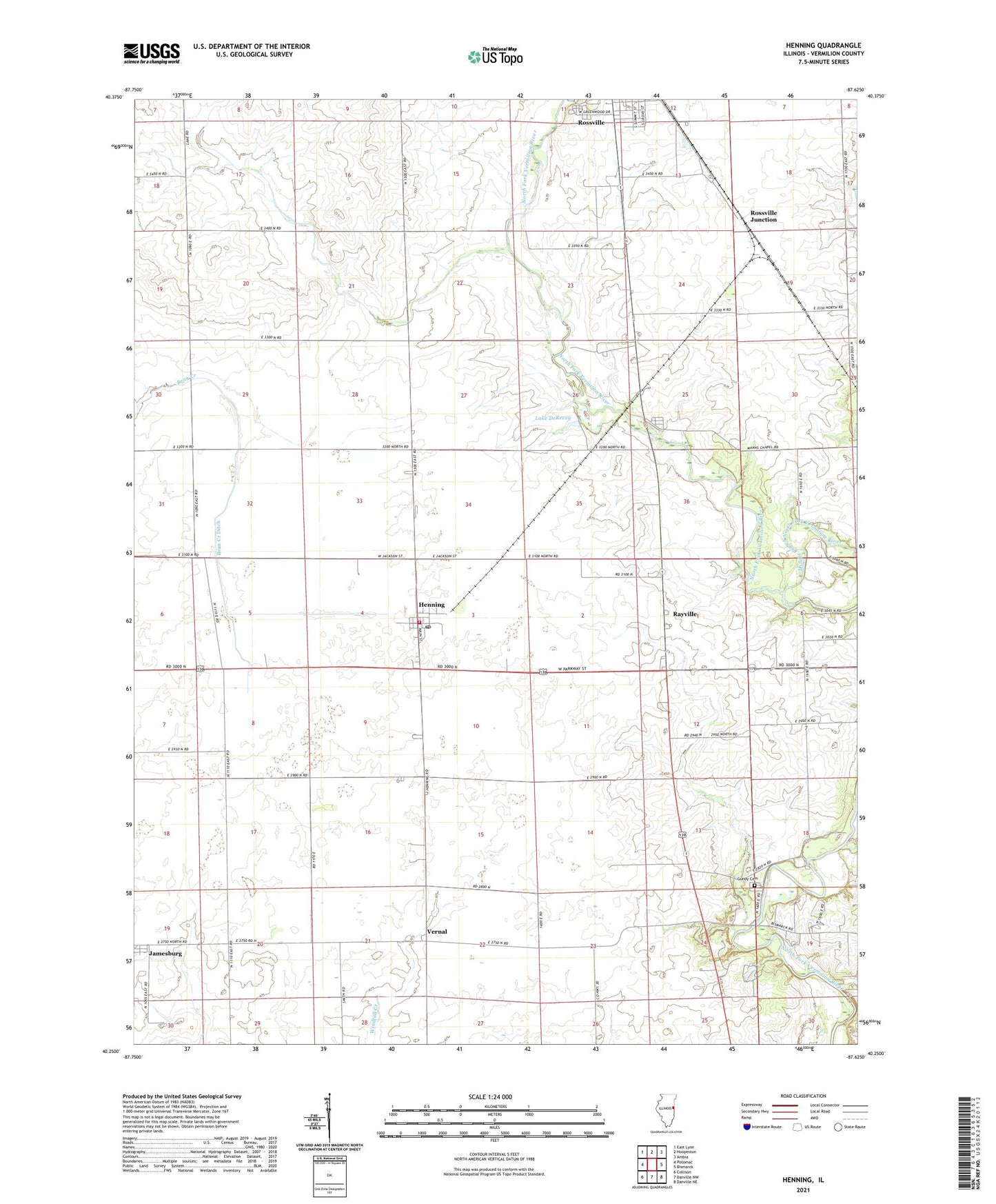
2024 topographic map quadrangle Henning in the state of Illinois. Scale: 1:24000. Based on the newly updated USGS 7.5' US Topo map series, this map is in the following counties: Vermilion. The map contains contour data, water features, and other items you are used to seeing on USGS maps, but also has updated roads and other features. This is the next generation of topographic maps. Printed on high-quality waterproof paper with UV fade-resistant inks.
Quads adjacent to this one:
West: Potomac
Northwest: East Lynn
North: Hoopeston
Northeast: Ambia
East: Bismarck
Southeast: Danville NE
South: Danville NW
Southwest: Collison
This map covers the same area as the classic USGS quad with code o40087c6.
Contains the following named places: Albright School, Bean Creek Ditch, Bismarck Community Fire Protection District, Centennial School, Central School, Christman Park, College Hill School, Cuba School, Gundy Cemetery, Henning, Henning High School, Jamesburg, Lake DeRevey, Lee School, Lincoln School, Manns Chapel, Middle Branch North Fork Vermilion River, Moores Corner, Myersville, Painter Creek, Rayville, Rickart School, Rossville Junction, Township of Ross, Township of South Ross, Vernal, Village of Henning, ZIP Codes: 60963, 61848