MyTopo
Bluford Illinois US Topo Map
Couldn't load pickup availability
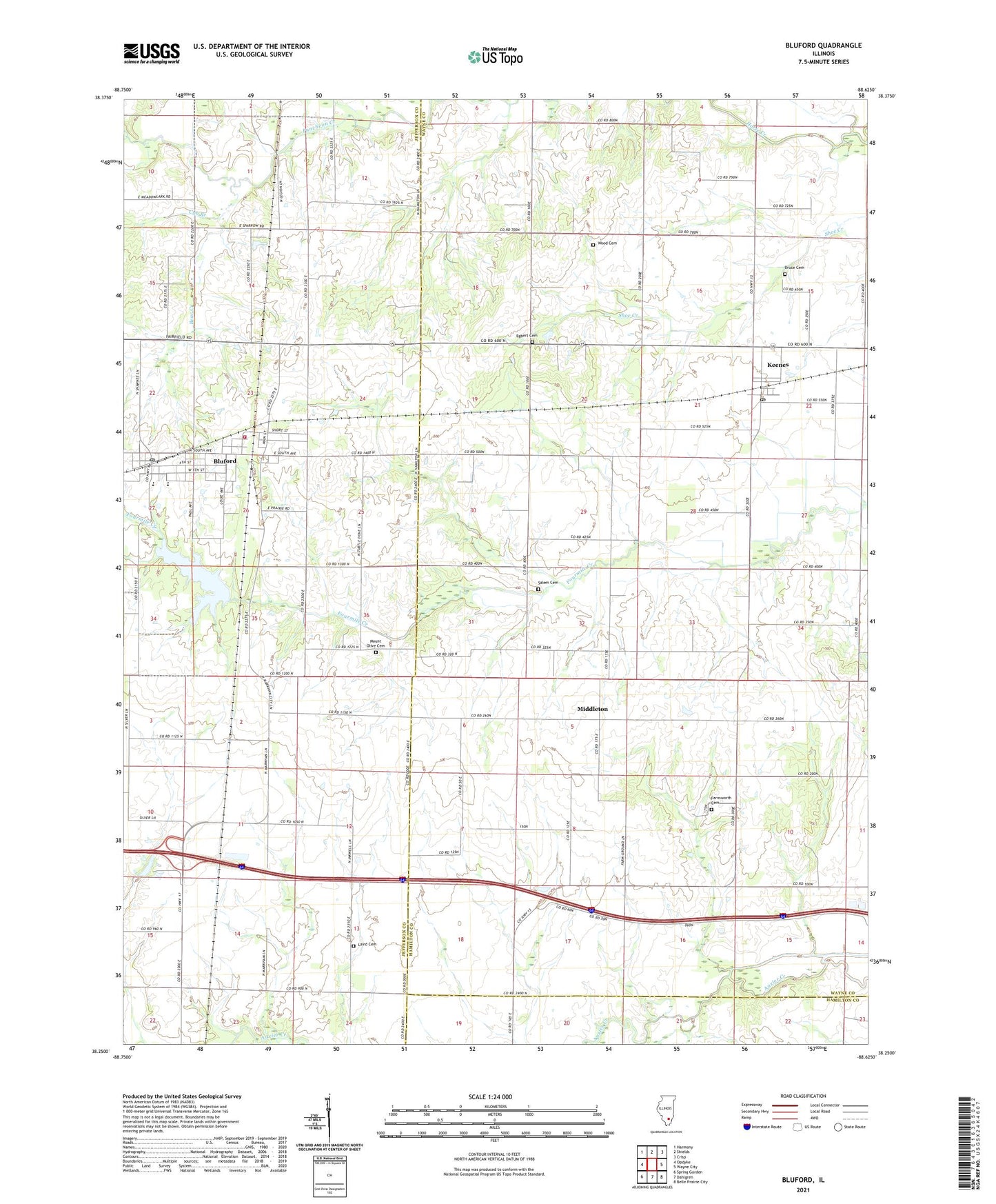
2024 topographic map quadrangle Bluford in the state of Illinois. Scale: 1:24000. Based on the newly updated USGS 7.5' US Topo map series, this map is in the following counties: Wayne, Jefferson, Hamilton. The map contains contour data, water features, and other items you are used to seeing on USGS maps, but also has updated roads and other features. This is the next generation of topographic maps. Printed on high-quality waterproof paper with UV fade-resistant inks.
Quads adjacent to this one:
West: Opdyke
Northwest: Harmony
North: Shields
Northeast: Crisp
East: Wayne City
Southeast: Belle Prairie City
South: Dahlgren
Southwest: Spring Garden
This map covers the same area as the classic USGS quad with code o38088c6.
Contains the following named places: Bear Creek, Bluford, Bluford Elementary School, Bluford Oil Field, Bluford Post Office, Bruce Cemetery, Cub Branch, Egbert Cemetery, Farnsworth Cemetery, First Baptist Church of Bluford, Grove School, Illinois Central Reservoir, Illinois Central Reservoir Dam, Keenes, Keenes Post Office, Laird Cemetery, Laird Church, Long Prairie Church, Long Prairie School, Markham City, Markham City Oil Field, Middleton, Mount Olive Cemetery, Mount Olive Church, Mount Zion Baptist Church, Number Nine School, Oakdale School, Oakland School, Pine Knot School, Salem Cemetery, Salem Church, Salem School, Scrub Hill School, Six Mile Post Office, Township of Four Mile, Village of Bluford, Village of Keenes, Webber Grove School, Webber Township Fire Protection District, Webber Township High School, Williamson School, Witherspoon School, Wood Cemetery