MyTopo
Wayne City Illinois US Topo Map
Couldn't load pickup availability
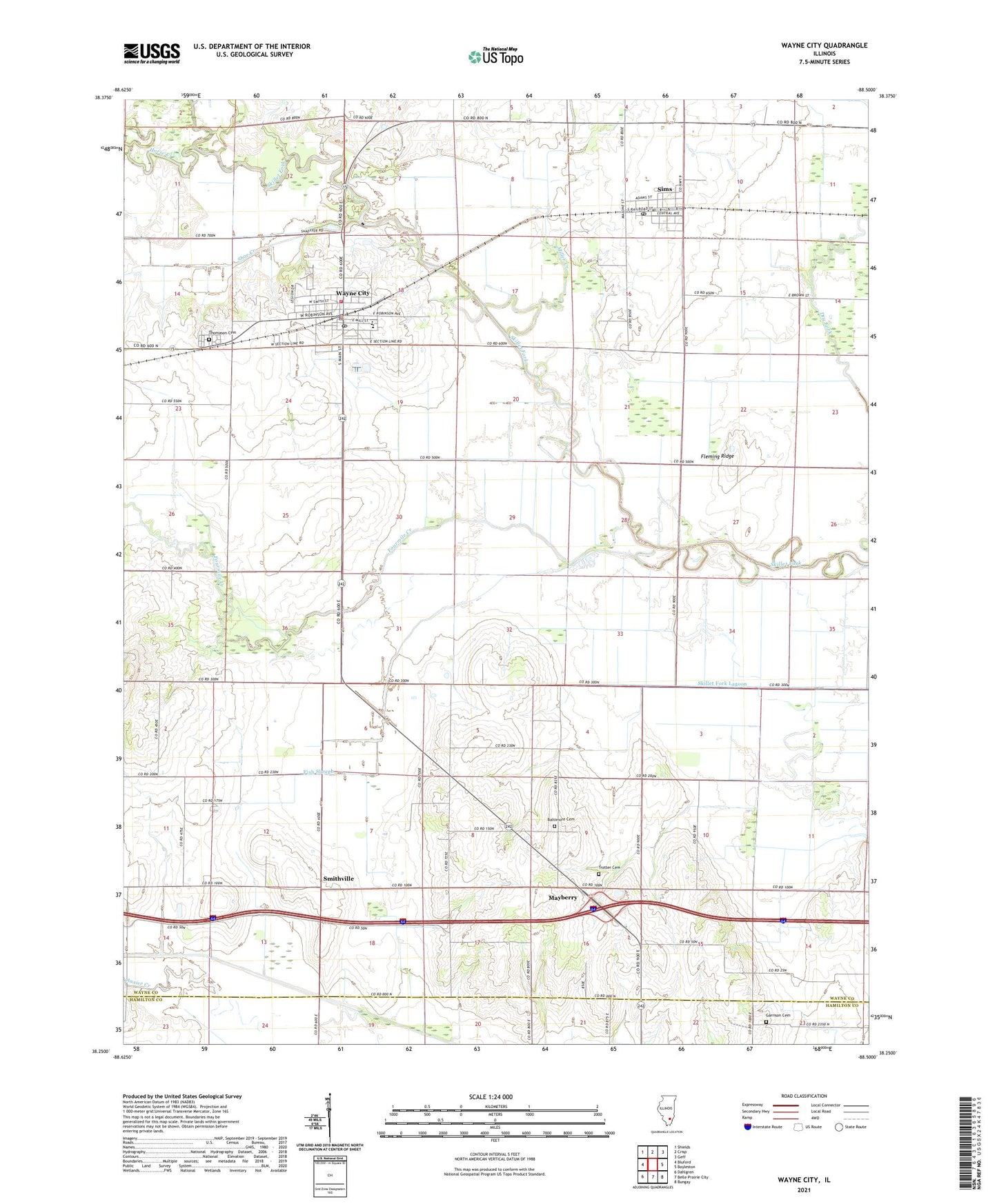
2024 topographic map quadrangle Wayne City in the state of Illinois. Scale: 1:24000. Based on the newly updated USGS 7.5' US Topo map series, this map is in the following counties: Wayne, Hamilton. The map contains contour data, water features, and other items you are used to seeing on USGS maps, but also has updated roads and other features. This is the next generation of topographic maps. Printed on high-quality waterproof paper with UV fade-resistant inks.
Quads adjacent to this one:
West: Bluford
Northwest: Shields
North: Crisp
Northeast: Geff
East: Boyleston
Southeast: Bungay
South: Belle Prairie City
Southwest: Dahlgren
This map covers the same area as the classic USGS quad with code o38088c5.
Contains the following named places: Baltimore Cemetery, Bloomfield School, Boyd School, Crossroads School, First Christian Church, First United Methodist Church, Fish Slough, Fleming Ridge, Fourmile Creek, Garrison Cemetery, Horse Creek, Independence School, Mayberry, Miller Creek, Miller School, Oak Grove Elementary School, Olive Branch Baptist Church, Pleasant Oak School, Richardson School, Shoe Creek, Sims, Sims Post Office, Skillet Fork Farm Airport, Smithville, Thomason Cemetery, Township of Arrington, Township of Orel, Trotter Cemetery, Trotter School, Village of Sims, Village of Wayne City, Wayne City, Wayne City Ambulance Service, Wayne City Baptist Church, Wayne City Elementary School, Wayne City High School, Wayne City Police Department, Wayne City Post Office, Wayne Fire Protection District 1, ZIP Code: 62895