MyTopo
Dahlgren Illinois US Topo Map
Couldn't load pickup availability
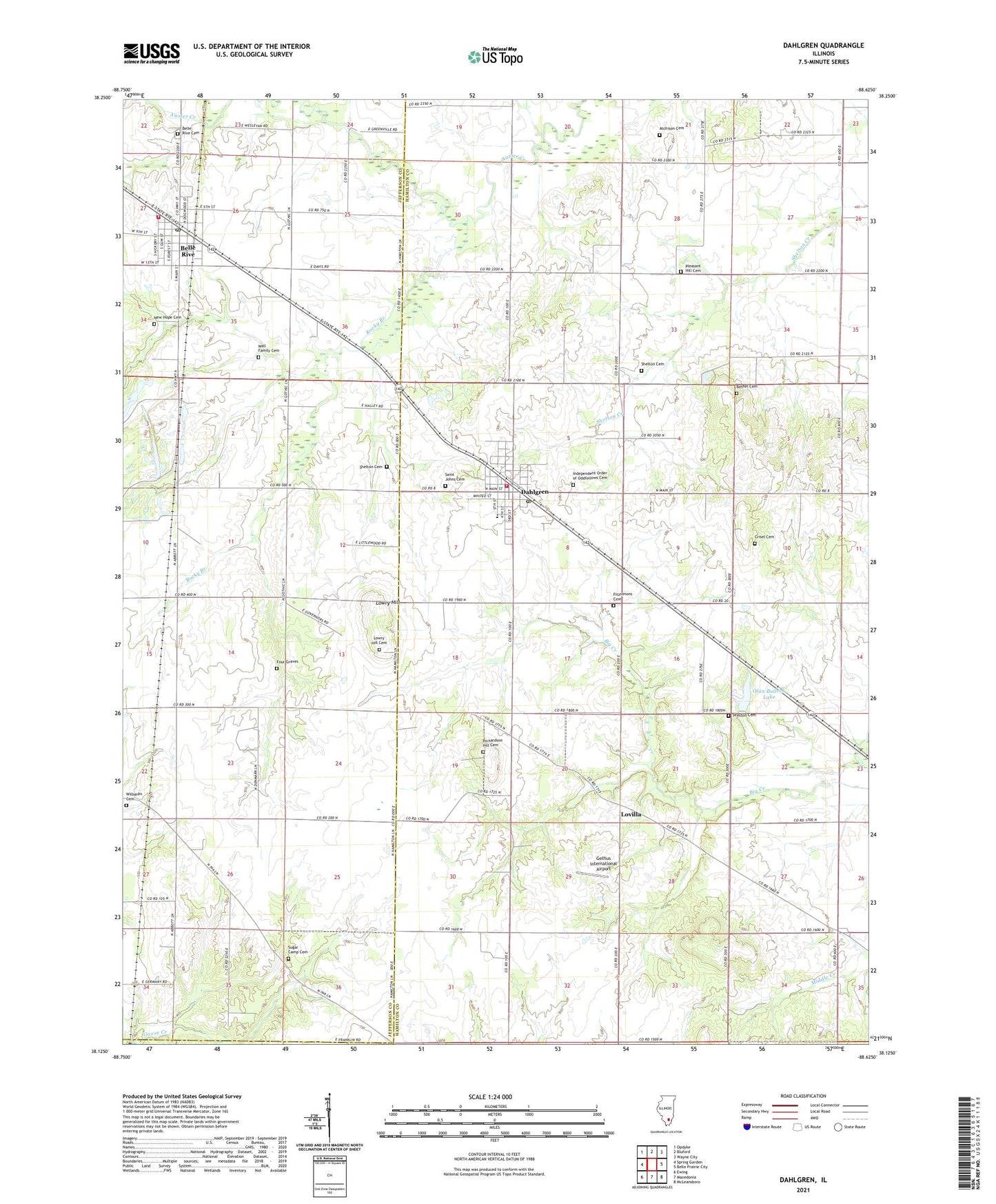
2024 topographic map quadrangle Dahlgren in the state of Illinois. Scale: 1:24000. Based on the newly updated USGS 7.5' US Topo map series, this map is in the following counties: Hamilton, Jefferson, Franklin. The map contains contour data, water features, and other items you are used to seeing on USGS maps, but also has updated roads and other features. This is the next generation of topographic maps. Printed on high-quality waterproof paper with UV fade-resistant inks.
Quads adjacent to this one:
West: Spring Garden
Northwest: Opdyke
North: Bluford
Northeast: Wayne City
East: Belle Prairie City
Southeast: McLeansboro
South: Macedonia
Southwest: Ewing
This map covers the same area as the classic USGS quad with code o38088b6.
Contains the following named places: Atchison Cemetery, Bell Point School, Belle Rive, Belle Rive Attendence Center, Belle Rive Cemetery, Belle Rive Fire Department, Belle Rive Post Office, Bethel Cemetery, Bethel Church, Cates School, Crisel Cemetery, Dahlgren, Dahlgren Elementary School, Dahlgren Fire Protection District, Dahlgren Post Office, Fairplay School, Fitzsimons Cemetery, Four Graves, Gelfius International Airport, Independent Order of Oddfellows Cemetery, Little Egypt Youth Camp, Lovilla, Lowry Hill, Lowry Hill Cemetery, Middle Creek Church, Middle Creek School, Moores Prairie School, New Hope Cemetery, Oak Grove School, Olan Bullock Lake, Olan Bullock Lake Dam, Pleasant Hill Cemetery, Pleasant Hill Church, Preston Cemetery, Preston School, Richardson Hill Cemetery, Richardson Hill Church, Rocky Branch, Saint Johns Cemetery, Shelton Cemetery, Sugar Camp Cemetery, Sugar Camp Church, Sunnyside School, Township of Dahlgren, Turner School, Union Grove School, Village of Belle Rive, Village of Dahlgren, Wall Family Cemetery, Wilbanks Cemetery