MyTopo
Bonfield Illinois US Topo Map
Couldn't load pickup availability
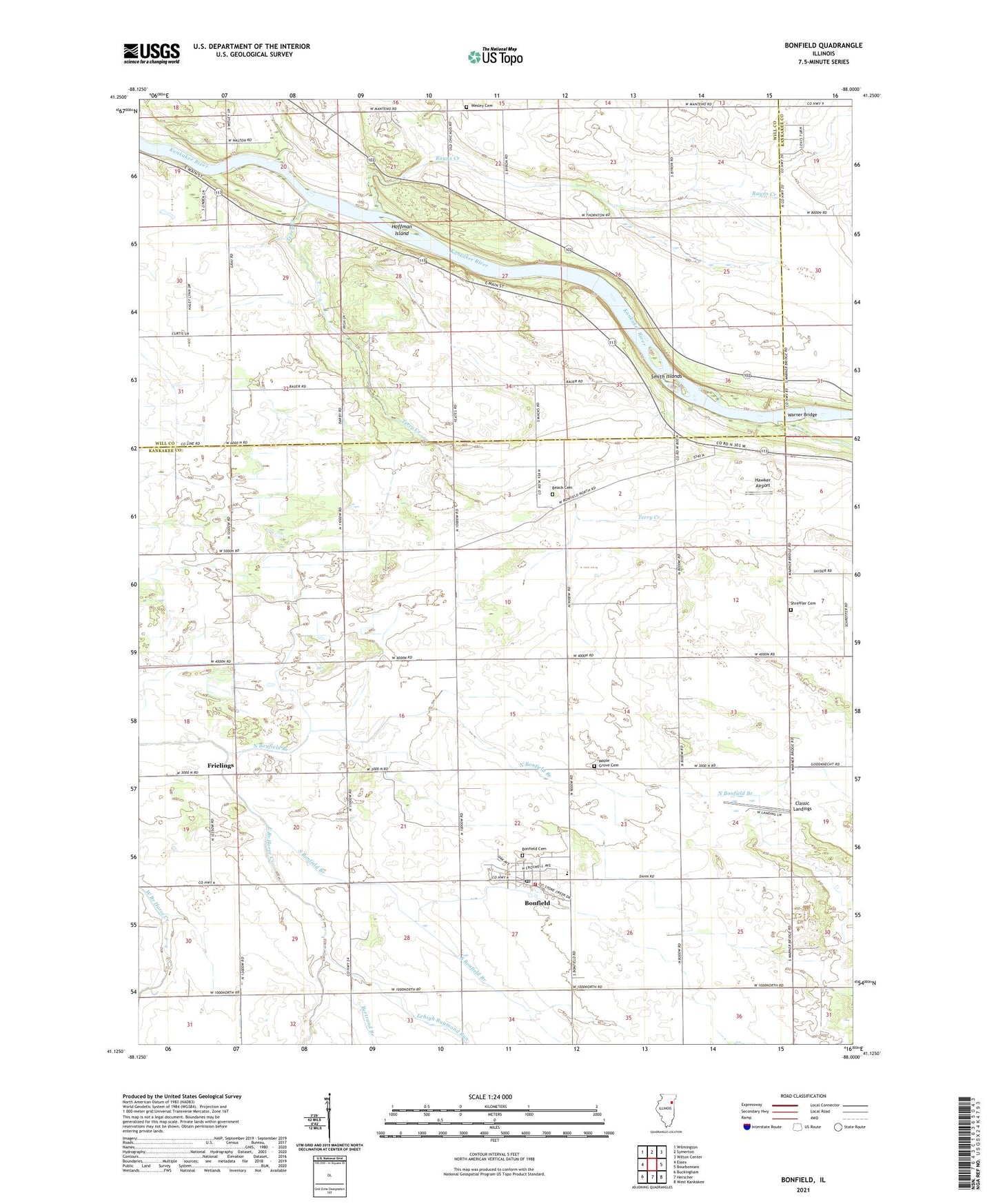
2024 topographic map quadrangle Bonfield in the state of Illinois. Scale: 1:24000. Based on the newly updated USGS 7.5' US Topo map series, this map is in the following counties: Kankakee, Will. The map contains contour data, water features, and other items you are used to seeing on USGS maps, but also has updated roads and other features. This is the next generation of topographic maps. Printed on high-quality waterproof paper with UV fade-resistant inks.
Quads adjacent to this one:
West: Essex
Northwest: Wilmington
North: Symerton
Northeast: Wilton Center
East: Bourbonnais
Southeast: West Kankakee
South: Herscher
Southwest: Buckingham
This map covers the same area as the classic USGS quad with code o41088b1.
Contains the following named places: Beach Cemetery, Bertrand Branch, Bonfield, Bonfield Cemetery, Bonfield First United Methodist Church, Bonfield Grade School, Bonfield Post Office, Classic Landings, Forked Bend Farm, Frielings, Hawker Airport, Hoffman Island, Horse Lake, Kankakee River State Park, Lehigh Raymond Run, Maple Grove Cemetery, McDowell Farm Post Office, North Bonfield Branch, Rayns Creek, Salina Post Office, Salina Township Fire Protection District, Shreffler Cemetery, Smith Islands, South Bonfield Branch, Terry Creek, Township of Salina, Village of Bonfield, Warner Bridge, Wesley Cemetery, ZIP Code: 60913