MyTopo
Wilton Center Illinois US Topo Map
Couldn't load pickup availability
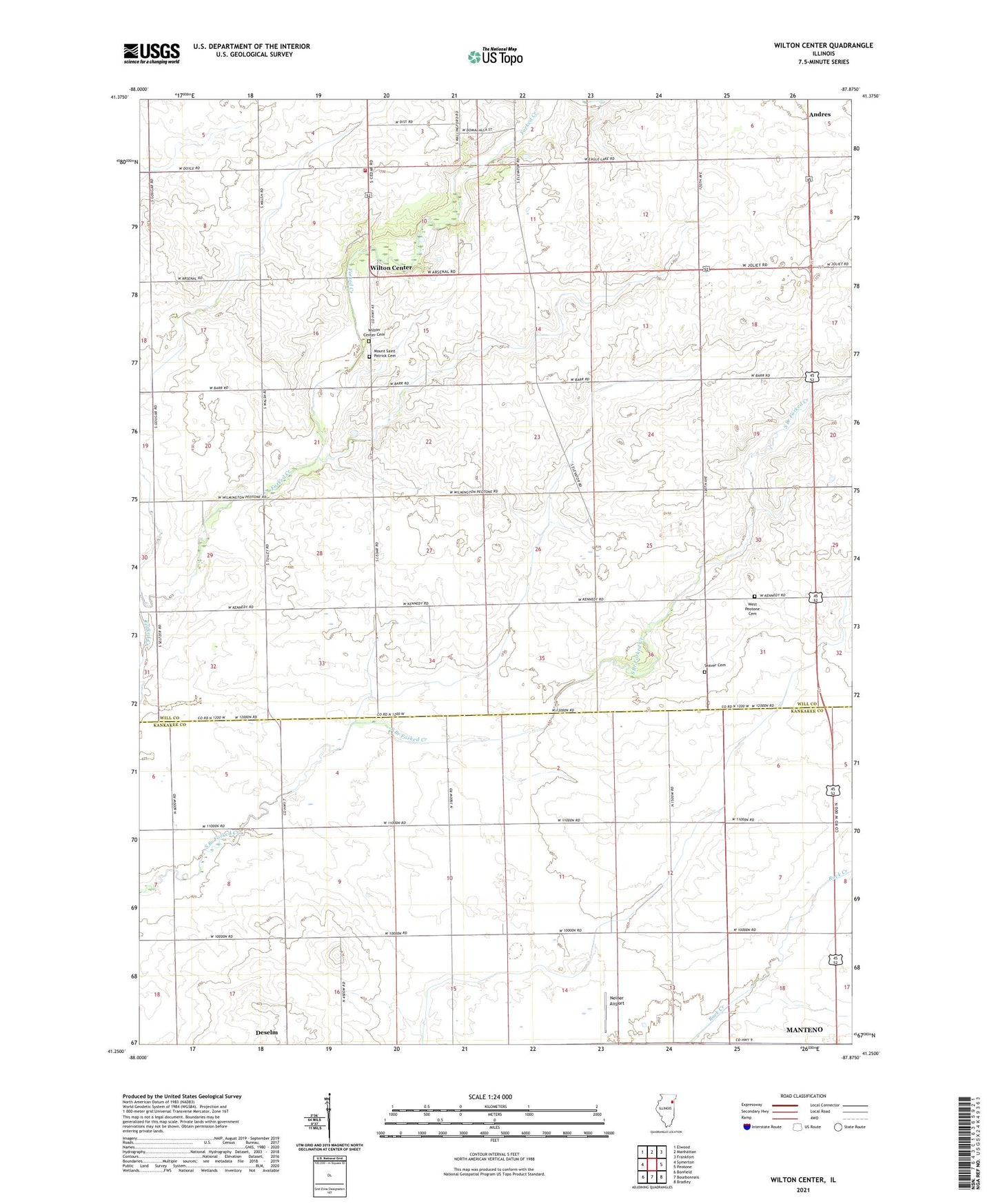
2024 topographic map quadrangle Wilton Center in the state of Illinois. Scale: 1:24000. Based on the newly updated USGS 7.5' US Topo map series, this map is in the following counties: Will, Kankakee. The map contains contour data, water features, and other items you are used to seeing on USGS maps, but also has updated roads and other features. This is the next generation of topographic maps. Printed on high-quality waterproof paper with UV fade-resistant inks.
Quads adjacent to this one:
West: Symerton
Northwest: Elwood
North: Manhattan
Northeast: Frankfort
East: Peotone
Southeast: Bradley
South: Bourbonnais
Southwest: Bonfield
This map covers the same area as the classic USGS quad with code o41087c8.
Contains the following named places: Andres, Andres Census Designated Place, Andres School, Crawford School, Gilkerson School, Hykes Grove School, Keigher School, Kelly School, Lamphere School, Manhattan Fire Protection District Station 82, McGowan School, Moran Landing Strip, Mount Saint Patrick Cemetery, Neiner Airport, Rice-School, Saint Patrick Catholic Church, Township of Wilton, Viall Homestead Airport, Wallingford, Wallingford School, West Peotone Cemetery, West Peotone Church, Will County Forest Preserve, Wilton Center, Wilton Center Cemetery, Wilton Center Census Designated Place, Wilton Center Elementary School, ZIP Code: 60950