MyTopo
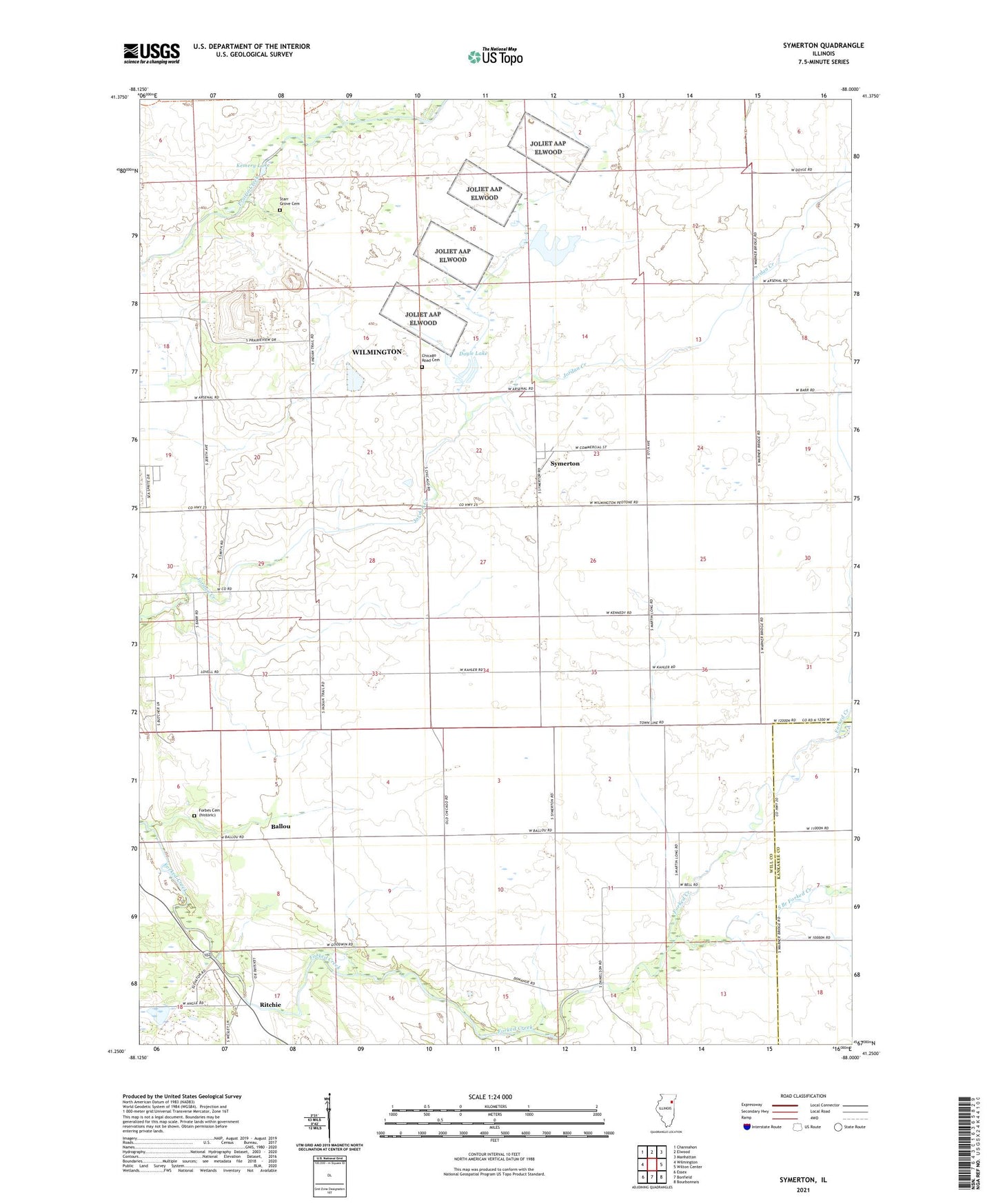
Symerton Illinois US Topo Map
Couldn't load pickup availability
Also explore the Symerton Forest Service Topo of this same quad for updated USFS data
2024 topographic map quadrangle Symerton in the state of Illinois. Scale: 1:24000. Based on the newly updated USGS 7.5' US Topo map series, this map is in the following counties: Will, Kankakee. The map contains contour data, water features, and other items you are used to seeing on USGS maps, but also has updated roads and other features. This is the next generation of topographic maps. Printed on high-quality waterproof paper with UV fade-resistant inks.
Quads adjacent to this one:
West: Wilmington
Northwest: Channahon
North: Elwood
Northeast: Manhattan
East: Wilton Center
Southeast: Bourbonnais
South: Bonfield
Southwest: Essex
This map covers the same area as the classic USGS quad with code o41088c1.
Contains the following named places: Ballou, Bell School, Center School, Chicago Road Cemetery, Doyle Lake, Doyle Lake Dam, Hayden School, Joliet Army Ammunition Plant Elwood, Kemery Lake, Kemery Lake Dam, Kennedy School, Morgan School, Oak Grove School, Ritchie, Ritchie Census Designated Place, Ritchie Station, School Number 66, South Branch Forked Creek, Starr Grove Cemetery, Starr Grove School, Symerton, Township of Florence, Township of Wesley, Village of Symerton, Wesley School, ZIP Code: 60481