MyTopo
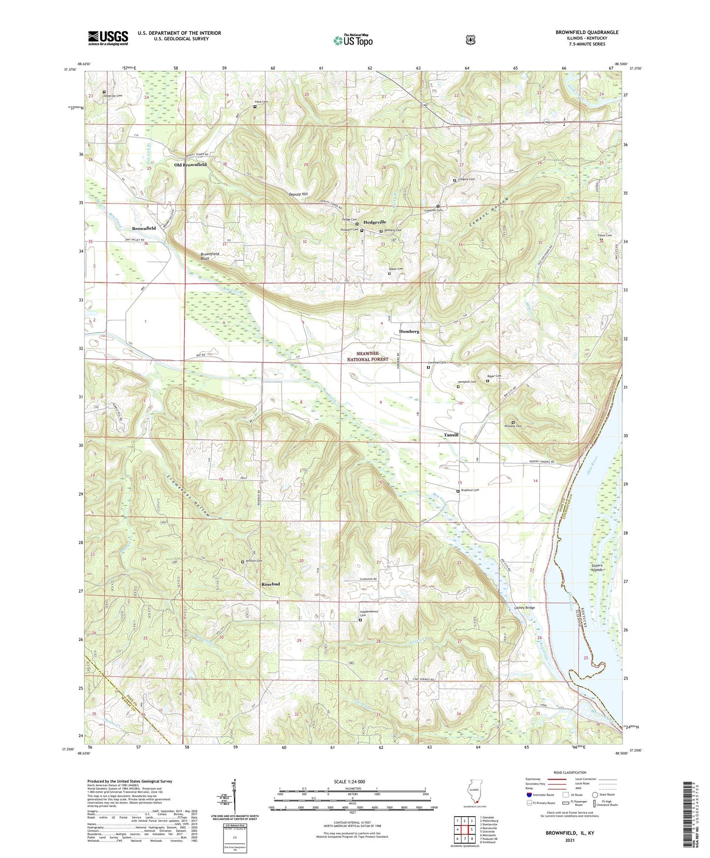
Brownfield Illinois US Topo Map
Couldn't load pickup availability
Also explore the Brownfield Forest Service Topo of this same quad for updated USFS data
2024 topographic map quadrangle Brownfield in the states of Illinois, Kentucky. Scale: 1:24000. Based on the newly updated USGS 7.5' US Topo map series, this map is in the following counties: Pope, Livingston, Massac. The map contains contour data, water features, and other items you are used to seeing on USGS maps, but also has updated roads and other features. This is the next generation of topographic maps. Printed on high-quality waterproof paper with UV fade-resistant inks.
Quads adjacent to this one:
West: Reevesville
Northwest: Glendale
North: Waltersburg
Northeast: Shetlerville
East: Golconda
Southeast: Smithland
South: Paducah NE
Southwest: Metropolis
Contains the following named places: Antioch Cemetery, Antioch Church, Baker Cemetery, Barren Creek, Bay Creek, Bethany Cemetery, Bethany Church, Bradford Cemetery, Brownfield, Brownfield Bluff, Brownfield Post Office, Caney Creek, Cave Creek, Cave Spring School, Cement Hollow, Compton Cemetery, Cooney Creek, Cromeenes Hollow, Deputy Hill, Deputy Lookout Tower, Field Cemetery, Flat Lick Branch, Foote Cemetery, Foreman Cemetery, Golconda Number 1 Election Precinct, Gregory Cemetery, Hemphill Cemetery, Hodge Cemetery, Hodgeville, Hodgeville School, Homberg, Independence Cemetery, Independence Church, Independence School, Lackey Bridge, Lewis Corner, Normal School, Old Brownfield, Pope County High School, Prospect Cemetery, Robnett Creek, Roper Cemetery, Ropers Landing, Rosebud, Shedville Cemetery, Sisters Islands, Stony Point School, Tansill, Williams Cemetery