MyTopo
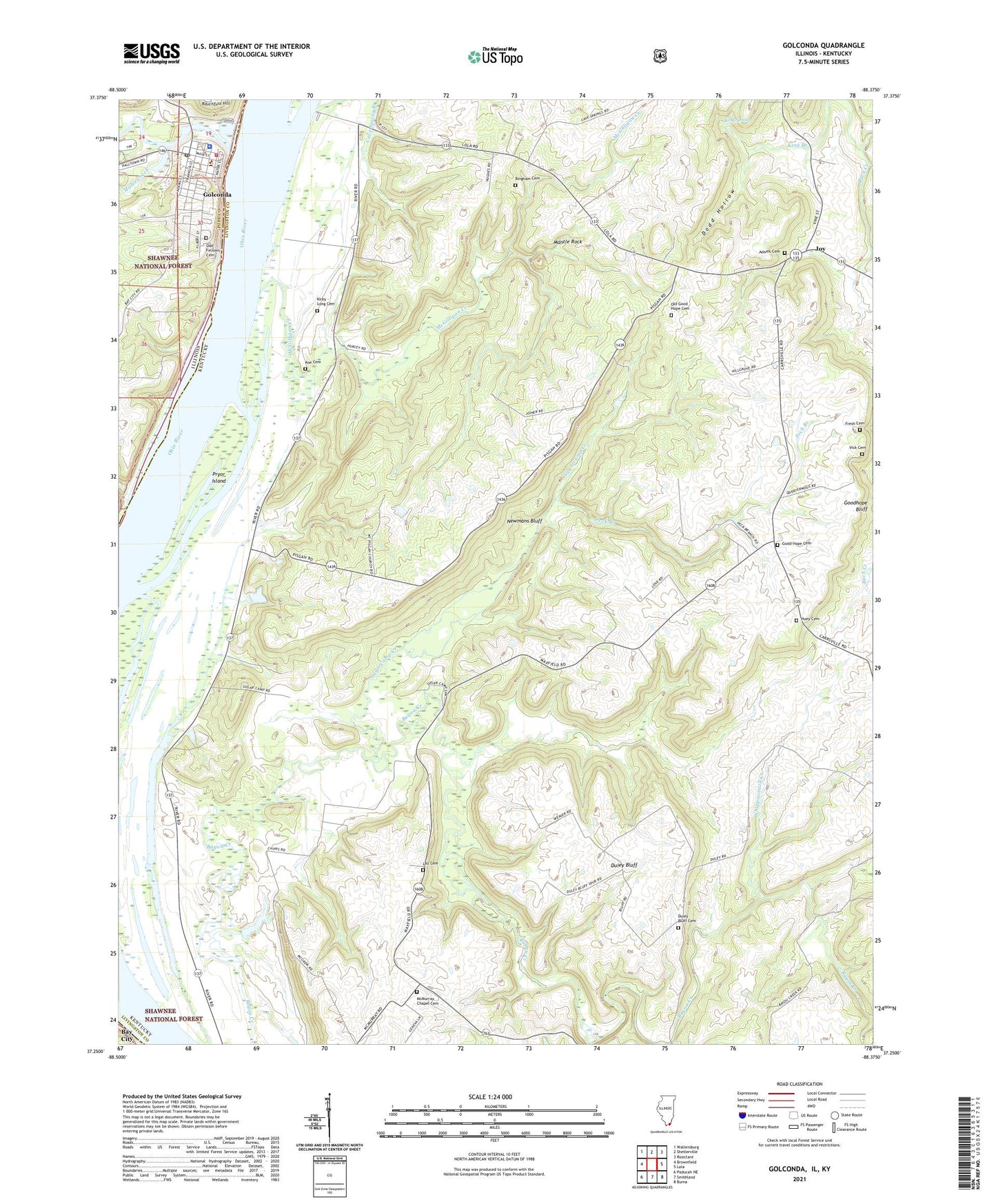
Golconda Illinois US Topo Map
Couldn't load pickup availability
Also explore the Golconda Forest Service Topo of this same quad for updated USFS data
2024 topographic map quadrangle Golconda in the states of Kentucky, Illinois. Scale: 1:24000. Based on the newly updated USGS 7.5' US Topo map series, this map is in the following counties: Pope, Livingston. The map contains contour data, water features, and other items you are used to seeing on USGS maps, but also has updated roads and other features. This is the next generation of topographic maps. Printed on high-quality waterproof paper with UV fade-resistant inks.
Quads adjacent to this one:
West: Brownfield
Northwest: Waltersburg
North: Shetlerville
Northeast: Rosiclare
East: Lola
Southeast: Burna
South: Smithland
Southwest: Paducah NE
Contains the following named places: Barton Landing Light, Cave Spring Church, City of Golconda, Dodd Hollow, Duley Bluff, Duley Bluff Cemetery, Givens Creek, Golconda, Golconda Historic District, Golconda Historic District National Register Site, Golconda Marina, Golconda Number 3 Election Precinct, Golconda Police Department, Golconda Post Office, Golconda Volunteer Fire Department, Goodhope Bluff, Goodhope Church, Joy, Joy School, King Spring, Kuebler School, Lay Cemetery, Lock and Dam Number 51, Lusk Creek, Lusk Creek Marina, Mantle Rock, McGilligan Creek, McMurray Chapel, Miller Creek, Mount Pisgah Church, Newmans Bluff, Ohio River Recreation Area, Peck Branch, Pope County Sheriff's Office, Pope County Volunteer Ambulance Service, Pryor Island, Rauchfuss Hill, Sadler Creek, Sugarcamp Creek, Wagman Chapel, Whippoorwill Creek, ZIP Code: 42047