MyTopo
Buda NE Illinois US Topo Map
Couldn't load pickup availability
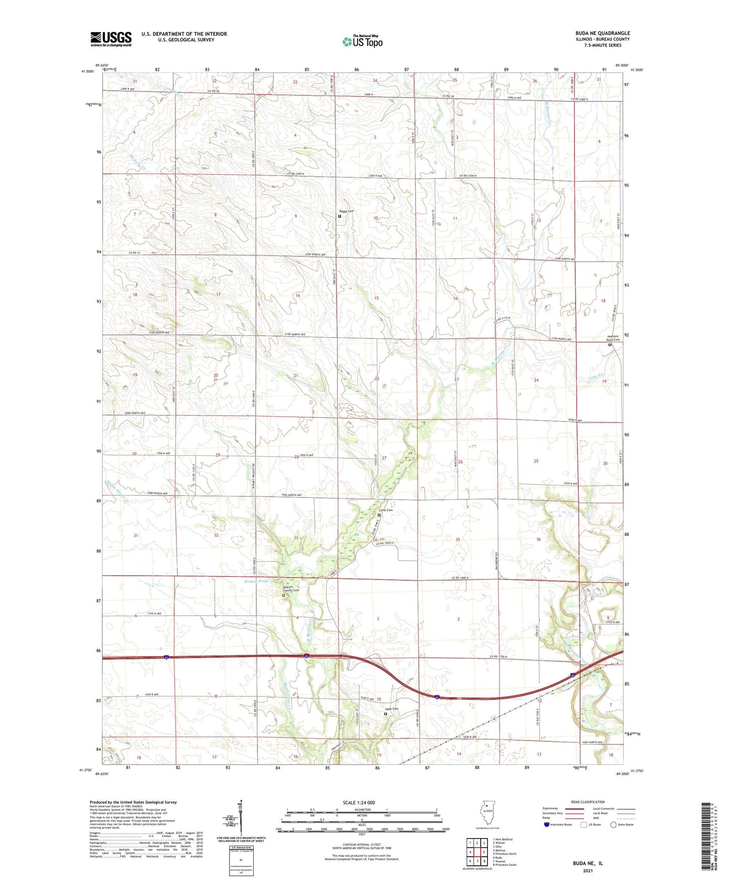
2024 topographic map quadrangle Buda NE in the state of Illinois. Scale: 1:24000. Based on the newly updated USGS 7.5' US Topo map series, this map is in the following counties: Bureau. The map contains contour data, water features, and other items you are used to seeing on USGS maps, but also has updated roads and other features. This is the next generation of topographic maps. Printed on high-quality waterproof paper with UV fade-resistant inks.
Quads adjacent to this one:
West: Manlius
Northwest: New Bedford
North: Walnut
Northeast: Ohio
East: Princeton North
Southeast: Princeton South
South: Wyanet
Southwest: Buda
This map covers the same area as the classic USGS quad with code o41089d5.
Contains the following named places: Aldrich Family Cemetery, Bureau County, Bureau Township School, Community Church, Corss Cemetery, Farmora School, Harrington School, Heatons Point Cemetery, Kauffman School, Krause Pond, Krause Pond Dam, Latta School, Lime Creek, Maple Grove Creek, Maple Grove School, Naffziger Landing Strip, Prior School, Roggy Cemetery, Sapp Cemetery, Sapp School, Township of Bureau, ZIP Code: 61379