MyTopo
Walnut Illinois US Topo Map
Couldn't load pickup availability
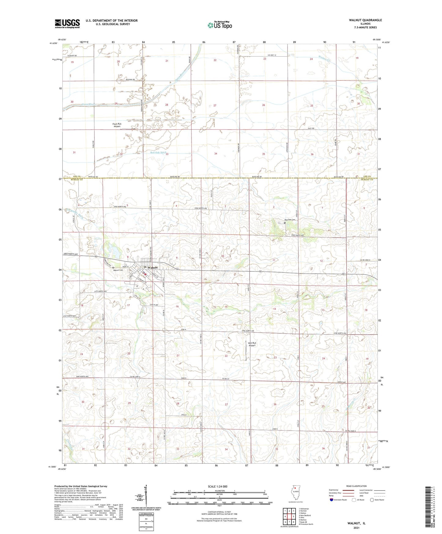
2024 topographic map quadrangle Walnut in the state of Illinois. Scale: 1:24000. Based on the newly updated USGS 7.5' US Topo map series, this map is in the following counties: Bureau, Lee. The map contains contour data, water features, and other items you are used to seeing on USGS maps, but also has updated roads and other features. This is the next generation of topographic maps. Printed on high-quality waterproof paper with UV fade-resistant inks.
Quads adjacent to this one:
West: New Bedford
Northwest: Hahnaman
North: Harmon
Northeast: Walton
East: Ohio
Southeast: Princeton North
South: Buda NE
Southwest: Manlius
This map covers the same area as the classic USGS quad with code o41089e5.
Contains the following named places: Bureau Valley North School, Chapel School, Fisch RLA Airport, Green River Golf Course, Holy Trinity Lutheran Church, Ioder Landing Strip, Pope School, Red Oak Cemetery, Red Oak Ditch, Red Oak United Methodist Church, Saint Johns Catholic Church, Steak City Feed Lot, Township of Walnut, Village of Walnut, Walnut, Walnut Cemetery, Walnut Fire Department, Walnut Police Department, Walnut Post Office, Walnut United Methodist Church, Wilt RLA Airport, ZIP Code: 61376