MyTopo
New Bedford Illinois US Topo Map
Couldn't load pickup availability
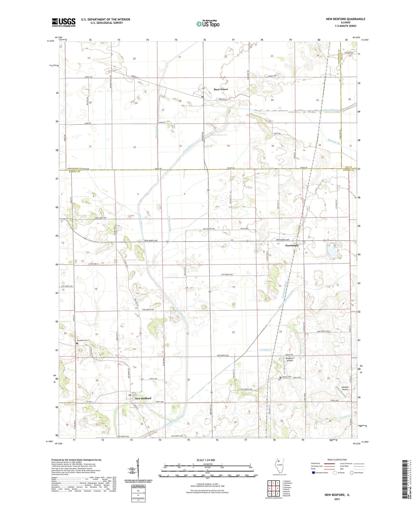
2024 topographic map quadrangle New Bedford in the state of Illinois. Scale: 1:24000. Based on the newly updated USGS 7.5' US Topo map series, this map is in the following counties: Bureau, Whiteside, Lee. The map contains contour data, water features, and other items you are used to seeing on USGS maps, but also has updated roads and other features. This is the next generation of topographic maps. Printed on high-quality waterproof paper with UV fade-resistant inks.
Quads adjacent to this one:
West: Yorktown
Northwest: Tampico
North: Hahnaman
Northeast: Harmon
East: Walnut
Southeast: Buda NE
South: Manlius
Southwest: Mineral
This map covers the same area as the classic USGS quad with code o41089e6.
Contains the following named places: Allen Creek, Baker Creek Ditch, Bowen Cemetery, Bowen School, Church School, Crooked Creek, Deer Grove, Deer Grove Post Office, Fairfield Cemetery, Geldean Airport, Hahnaman Elementary School, Little Deer Grove, Maple Grove School, Meek School, New Bedford, New Bedford Post Office, Normandy, Normandy Ditch, Normandy Post Office, Reeves School, Sunset Ridge Emergency Medical Services, Swanson School, Township of Greenville, Village of Deer Grove, Village of New Bedford, Walnut Creek, Walnut Special Ditch, White School, Woodley 2 Airport, Woodley Aerial Spray Airport, ZIP Codes: 61243, 61346