MyTopo
Mount Erie Illinois US Topo Map
Couldn't load pickup availability
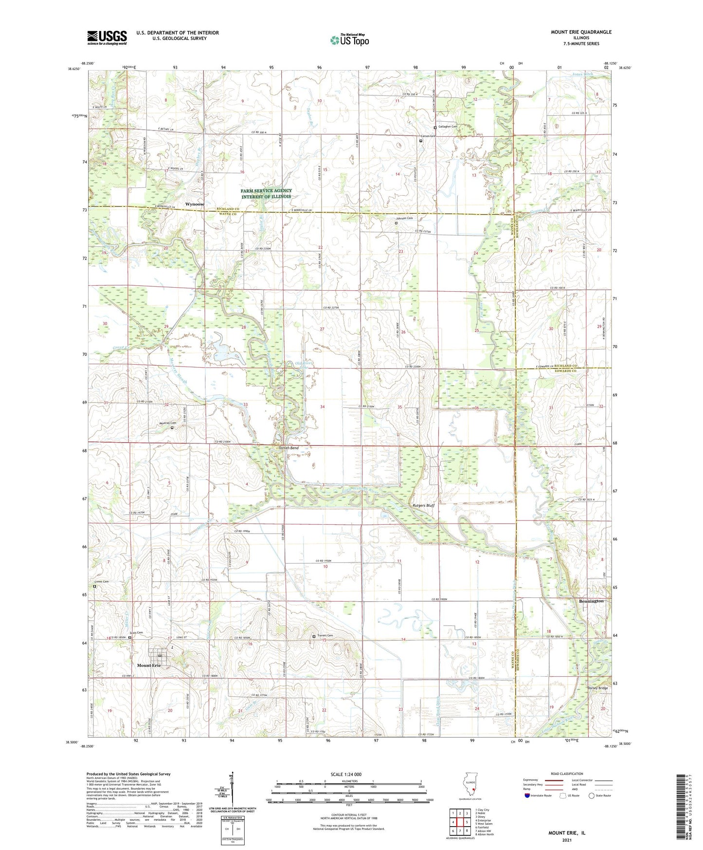
2024 topographic map quadrangle Mount Erie in the state of Illinois. Scale: 1:24000. Based on the newly updated USGS 7.5' US Topo map series, this map is in the following counties: Wayne, Richland, Edwards, Clay. The map contains contour data, water features, and other items you are used to seeing on USGS maps, but also has updated roads and other features. This is the next generation of topographic maps. Printed on high-quality waterproof paper with UV fade-resistant inks.
Quads adjacent to this one:
West: Enterprise
Northwest: Clay City
North: Noble
Northeast: Olney
East: West Salem
Southeast: Albion North
South: Albion NW
Southwest: Fairfield
This map covers the same area as the classic USGS quad with code o38088e2.
Contains the following named places: Barton School, Bennington, Blood School, C B and Q Railroad Reservoir, C B and Q Railroad Reservoir Dam, Calhoun Oil Field, Calhoun South Oil Field, Carson Cemetery, Crews Cemetery, Cross Diversion Ditch, Dorsey Bridge, Farmer School, Forest Ridge Church, Fox River, Gallagher Cemetery, Gentry Creek, Goose Pond, Grove Creek, Gum Branch, Hedrick School, Hughes Branch, Johnson Cemetery, Maple Grove Oil Field, Miller Creek, Miller Creek School, Moultrie School, Mount Erie, Mount Erie Elementary School, Mount Erie Post Office, Mount Erie Townhall, Moutray Cemetery, Moutray Slough, Newton Branch, North Ridge School, Old River Lake, Providence Church, Rutgers Bluff, Scott Cemetery, Seminary, Seminary School, Seminary Tabernacle, Shannon Bridge, South Ridge School, Sugar Creek, Taylor Branch, Totten Bend, Township of Mount Erie, Travers Cemetery, Village of Mount Erie, Wynoose, ZIP Code: 62446