MyTopo
Noble Illinois US Topo Map
Couldn't load pickup availability
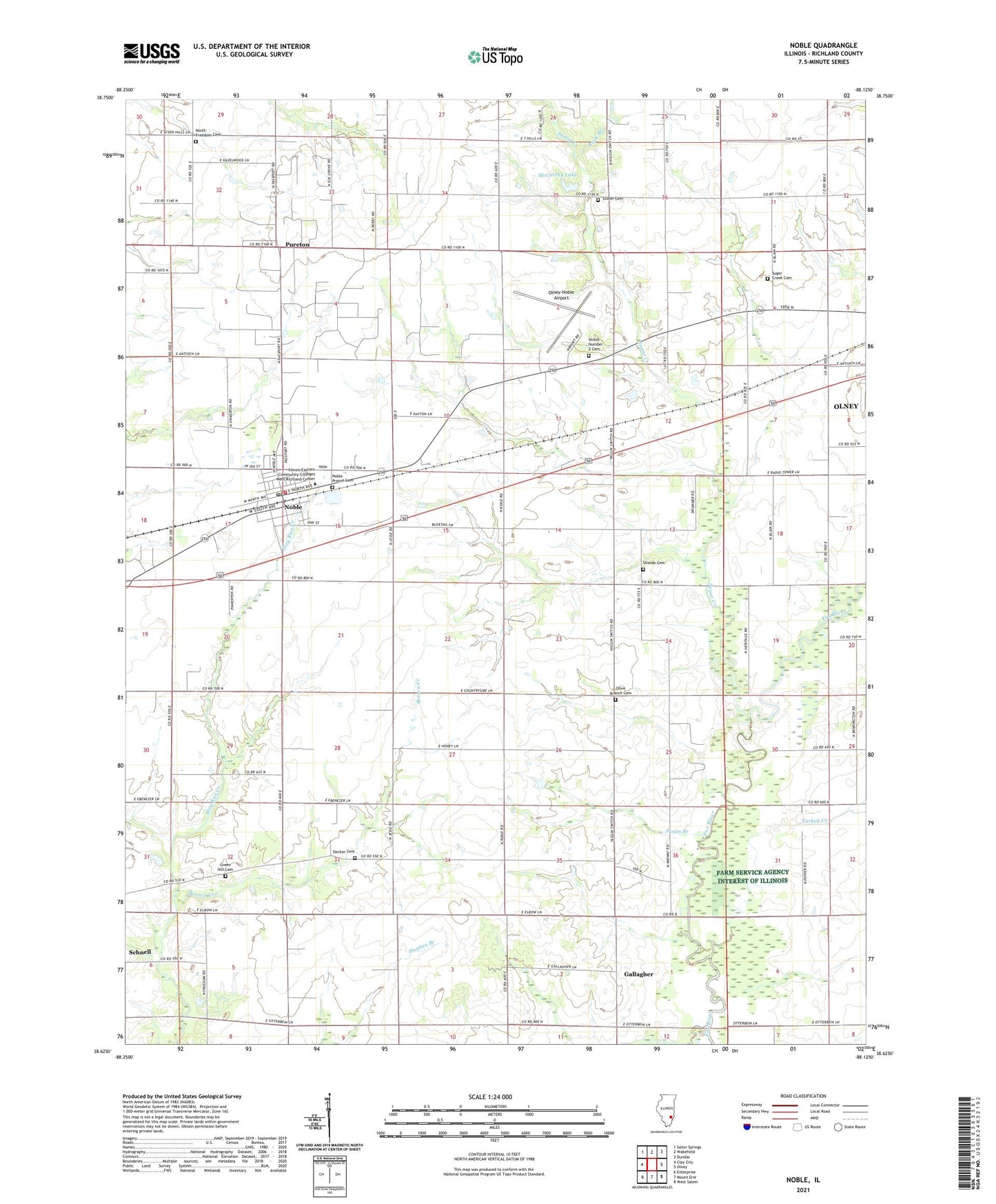
2024 topographic map quadrangle Noble in the state of Illinois. Scale: 1:24000. Based on the newly updated USGS 7.5' US Topo map series, this map is in the following counties: Richland. The map contains contour data, water features, and other items you are used to seeing on USGS maps, but also has updated roads and other features. This is the next generation of topographic maps. Printed on high-quality waterproof paper with UV fade-resistant inks.
Quads adjacent to this one:
West: Clay City
Northwest: Sailor Springs
North: Wakefield
Northeast: Dundas
East: Olney
Southeast: West Salem
South: Mount Erie
Southwest: Enterprise
This map covers the same area as the classic USGS quad with code o38088f2.
Contains the following named places: Antioch Church, Barlow School, Blue Ridge School, Brown Creek, Cornerstone Community Church, Decker Cemetery, Decker Townhall, Elston Cemetery, Elwood School, First Christian Church, Fransonia, Fransonia School, Freedom School, Gallagher, Gallagher School, Green Hill Cemetery, McCarthy Lake, McCauley School, Noble, Noble Post Office, Noble Prairie Cemetery, Noble United Methodist Church, Noble Wakefield Fire Protection District, North Freedom Cemetery, North Freedom Church, Olive Branch Cemetery, Olive Branch Church, Olney-Noble Airport, Pleasant View Church, Pureton, Rock Branch, Rock Branch School, Schnell, Schnell East Oil Field, Shields Cemetery, Shields School, Shiloh Number 2 Cemetery, Sugar Creek, Sugar Creek Cemetery, Sugar Creek Church, Sunnyside School, Susan Branch, Taylor School, Totten School, Township of Decker, Township of Noble, Turkey Creek, Van Matre School, Village of Noble, West Richland Elementary School, West Richland High School, ZIP Code: 62868