MyTopo
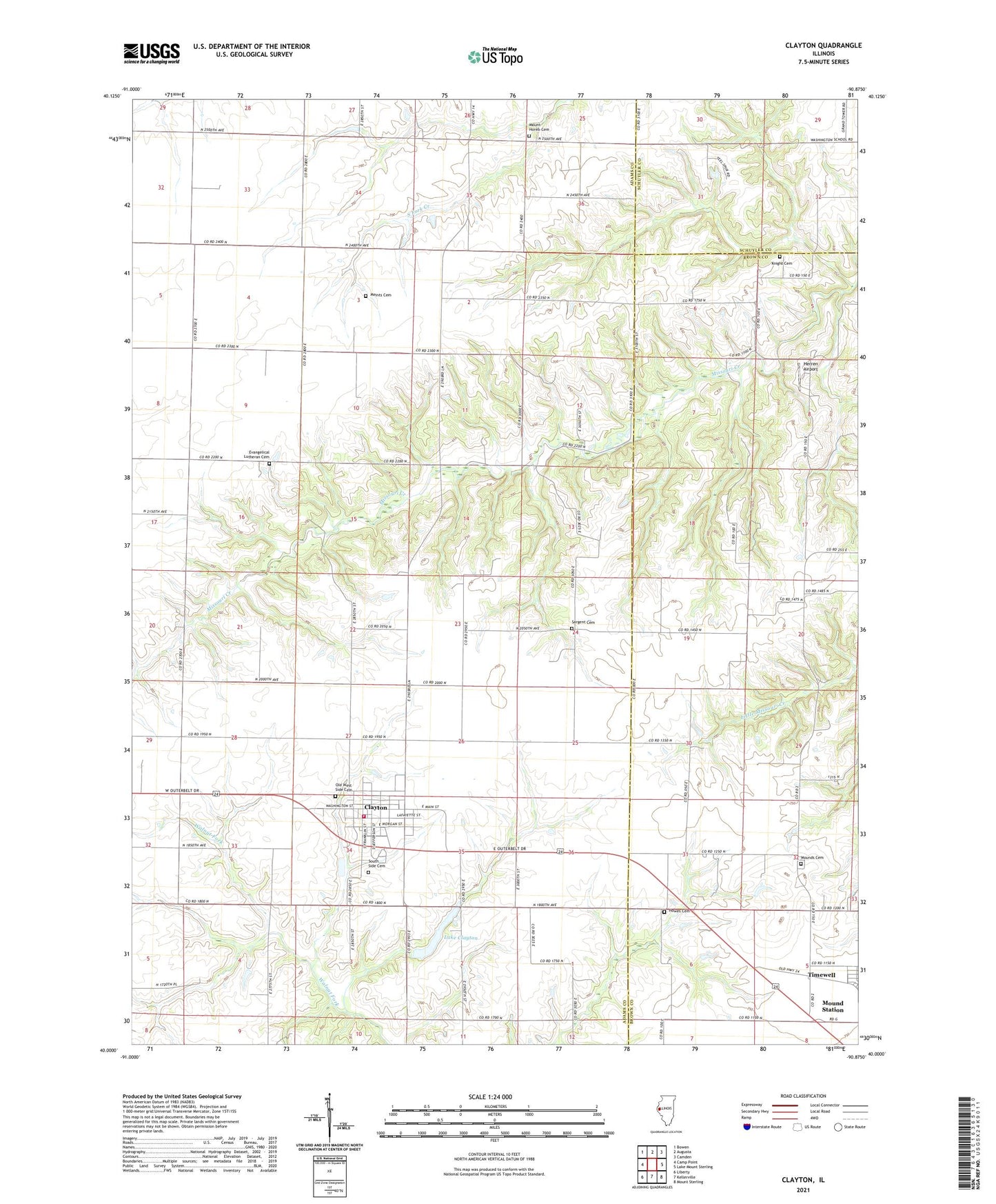
Clayton Illinois US Topo Map
Couldn't load pickup availability
2024 topographic map quadrangle Clayton in the state of Illinois. Scale: 1:24000. Based on the newly updated USGS 7.5' US Topo map series, this map is in the following counties: Adams, Brown, Schuyler. The map contains contour data, water features, and other items you are used to seeing on USGS maps, but also has updated roads and other features. This is the next generation of topographic maps. Printed on high-quality waterproof paper with UV fade-resistant inks.
Quads adjacent to this one:
West: Camp Point
Northwest: Bowen
North: Augusta
Northeast: Camden
East: Lake Mount Sterling
Southeast: Mount Sterling
South: Kellerville
Southwest: Liberty
This map covers the same area as the classic USGS quad with code o40090a8.
Contains the following named places: Blacks, Clayton, Clayton Christian Church, Clayton Fire Protection District, Clayton Reservoir Dam, Evangelical Lutheran Cemetery, First Federated Church, Good Shepherd Lutheran Church, Hazel Dell School, Herren Airport, Howes Cemetery, Knight Cemetery, Lake Clayton, Logue School, Meints Cemetery, Mound School, Mounds Cemetery, Mount Horeb Cemetery, Mount Horeb Church, Old West Side Cemetery, Poe School, Sargent Cemetery, Shank School, South Prairie School, South Side Cemetery, Sulphur Springs School, Township of Clayton, Union School, Village of Clayton