MyTopo
Kellerville Illinois US Topo Map
Couldn't load pickup availability
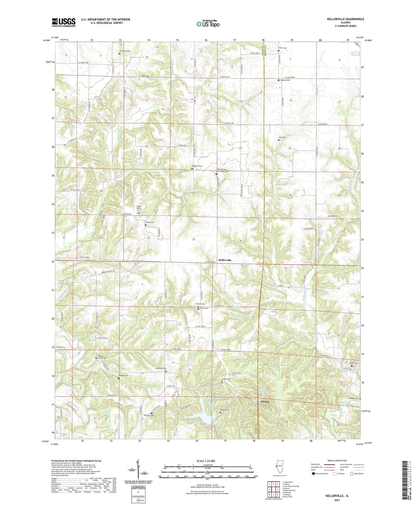
2024 topographic map quadrangle Kellerville in the state of Illinois. Scale: 1:24000. Based on the newly updated USGS 7.5' US Topo map series, this map is in the following counties: Adams, Brown. The map contains contour data, water features, and other items you are used to seeing on USGS maps, but also has updated roads and other features. This is the next generation of topographic maps. Printed on high-quality waterproof paper with UV fade-resistant inks.
Quads adjacent to this one:
West: Liberty
Northwest: Camp Point
North: Clayton
Northeast: Lake Mount Sterling
East: Mount Sterling
Southeast: Perry West
South: Fishhook
Southwest: Richfield
This map covers the same area as the classic USGS quad with code o39090h8.
Contains the following named places: Amen Cemetery, Amen School, Ashland School, Ausmus Cemetery, Bixler Cemetery, Burden Cemetery, Coal Creek, Colpitt School, Concord Townhall, Crabapple Lake, Crabapple Trail, Deer Run Trail, Dunkard Cemetery, Durbin Branch, Durbin Cemetery, Ferguson School, Friendly School, Grady Cemetery, Grindstone Creek, Harwood Cemetery, Hickory Hill Campground, Higley Family Cemetery, Hoot Owl Trail, Jefferson Cemetery, Kellerville, Lee Cemetery, Lierly Cemetery, Little Missouri School, Mayfield Landing Strip, McKee Townhall, Oak Ridge Campground, Oakland School, Old Siloam Picnic Area, Old Village Trail, Orton Cemetery, Padgett Cemetery, Pea Green School, Pine Grove Campground, Prairie Bluff Trail, Purpus Creek, Red Oak Backpack Trail, Siloam, Siloam Springs, Siloam Springs Lake, Siloam Springs Lake Dam, Siloam Springs State Park, Spring Valley, Spring Valley Cemetery, Spring Valley Church, Spring Valley School, Stevens Cemetery, Township of Concord, Township of McKee, Washington Grove School, Wells Fork, Williams School, ZIP Code: 62324