MyTopo
Liberty Illinois US Topo Map
Couldn't load pickup availability
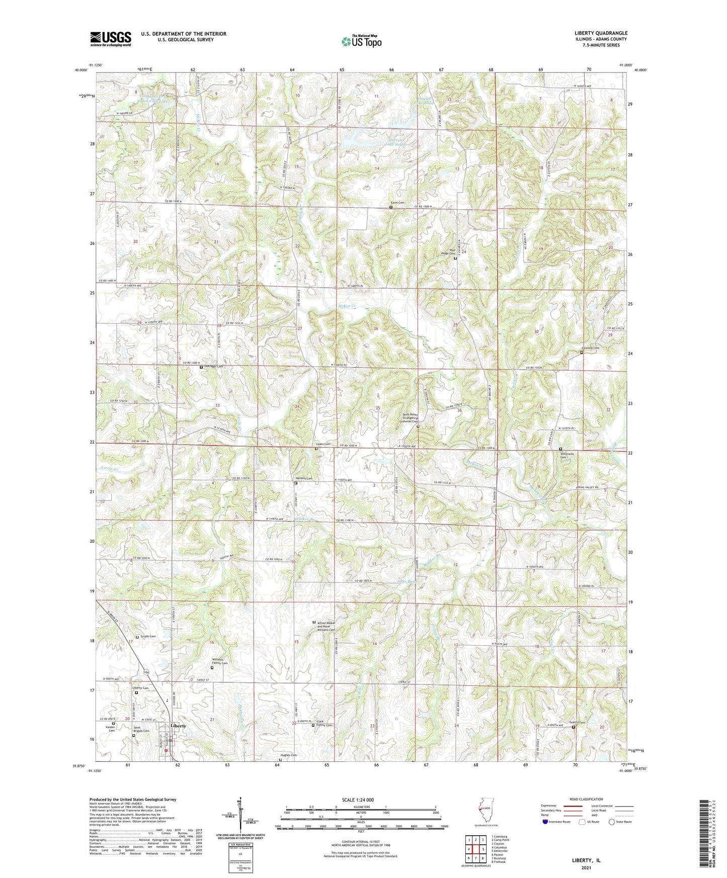
2024 topographic map quadrangle Liberty in the state of Illinois. Scale: 1:24000. Based on the newly updated USGS 7.5' US Topo map series, this map is in the following counties: Adams. The map contains contour data, water features, and other items you are used to seeing on USGS maps, but also has updated roads and other features. This is the next generation of topographic maps. Printed on high-quality waterproof paper with UV fade-resistant inks.
Quads adjacent to this one:
West: Columbus
Northwest: Coatsburg
North: Camp Point
Northeast: Clayton
East: Kellerville
Southeast: Fishhook
South: Richfield
Southwest: Payson
This map covers the same area as the classic USGS quad with code o39091h1.
Contains the following named places: Adams County Ambulance - Liberty Station, Alfred Walker and Peter Williams Cemetery, Camp Callahan, Camp Mohawk, Center Union School, Chaplin School, Clark Family Cemetery, Coats Cemetery, Columbus Dry Gulch Club Lake, Columbus Dry Gulch Club Lake Dam, Concord Cemetery, Curl Creek, Earel Cemetery, East Union School, Elmwood School, Excelsior School, Figley Branch, Fisher Branch, Goertz Cemetery, Grubb Cemetery, Harrell Lake Dam South, Harrell Lake North, Harrell Lake North Dam, Harrell Lake South, Hazel Bluff School, Hufnagel Cemetery, Hughes Cemetery, Liberty, Liberty Cemetery, Liberty Fire Protection District, Liberty High School, Liberty Post Office, Lierle Creek, Lost Prairie Church, Lost Prairie School, Nations Cemetery, North Rock School, Robinson School, Saint Brigids Cemetery, Saint Peters Evangelical Lutheran Cemetery, Sims Pond, Sims Pond Dam, Township of Columbus, Township of Liberty, Village of Liberty, Walker Branch, Walnut Fork, Williams Family Cemetery, Willow Branch, Wolf Ridge Cemetery, Xander Cemetery