MyTopo
Camp Point Illinois US Topo Map
Couldn't load pickup availability
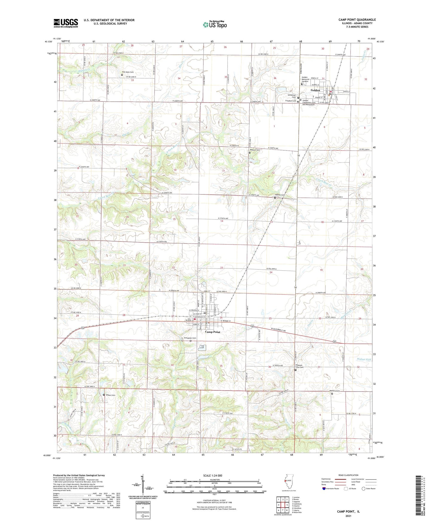
2024 topographic map quadrangle Camp Point in the state of Illinois. Scale: 1:24000. Based on the newly updated USGS 7.5' US Topo map series, this map is in the following counties: Adams. The map contains contour data, water features, and other items you are used to seeing on USGS maps, but also has updated roads and other features. This is the next generation of topographic maps. Printed on high-quality waterproof paper with UV fade-resistant inks.
Quads adjacent to this one:
West: Coatsburg
Northwest: Loraine
North: Bowen
Northeast: Augusta
East: Clayton
Southeast: Kellerville
South: Liberty
Southwest: Columbus
This map covers the same area as the classic USGS quad with code o40091a1.
Contains the following named places: Adams County Ambulance Emergency Medical Services, Bailey Park, Blue Stocking School, Camp Point, Camp Point Fire Protection District, Camp Point Police Department, Camp Point Post Office, Camp Point United Methodist Church, Center School, Central Elementary School, Central High School, Craigtown School, Evergreen Cemetery, Faith Church, First Christian Church, Friedhof Cemetery, Golden, Golden Fire Protection District, Golden Memorial Gardens, Golden Post Office, Hazelwood School, Hebron Cemetery, Highland School, Holy Cross Lutheran Church, Immanuel Lutheran Church, Locust Grove School, Maplewood School, Mission Ridge School, North Branch McKee Creek, Oakwood School, Pleasant View Cemetery, Primrose School, Saint Thomas Church, Searls Field, Searls RLA 59 Airport, Township of Camp Point, Trinity Lutheran Church, Union School, Village of Camp Point, Village of Golden, Wallace Cemetery, Washington School, Wilkes Cemetery, York Neck Cemetery, Yorknic Church, ZIP Code: 62320