MyTopo
Coulterville Illinois US Topo Map
Couldn't load pickup availability
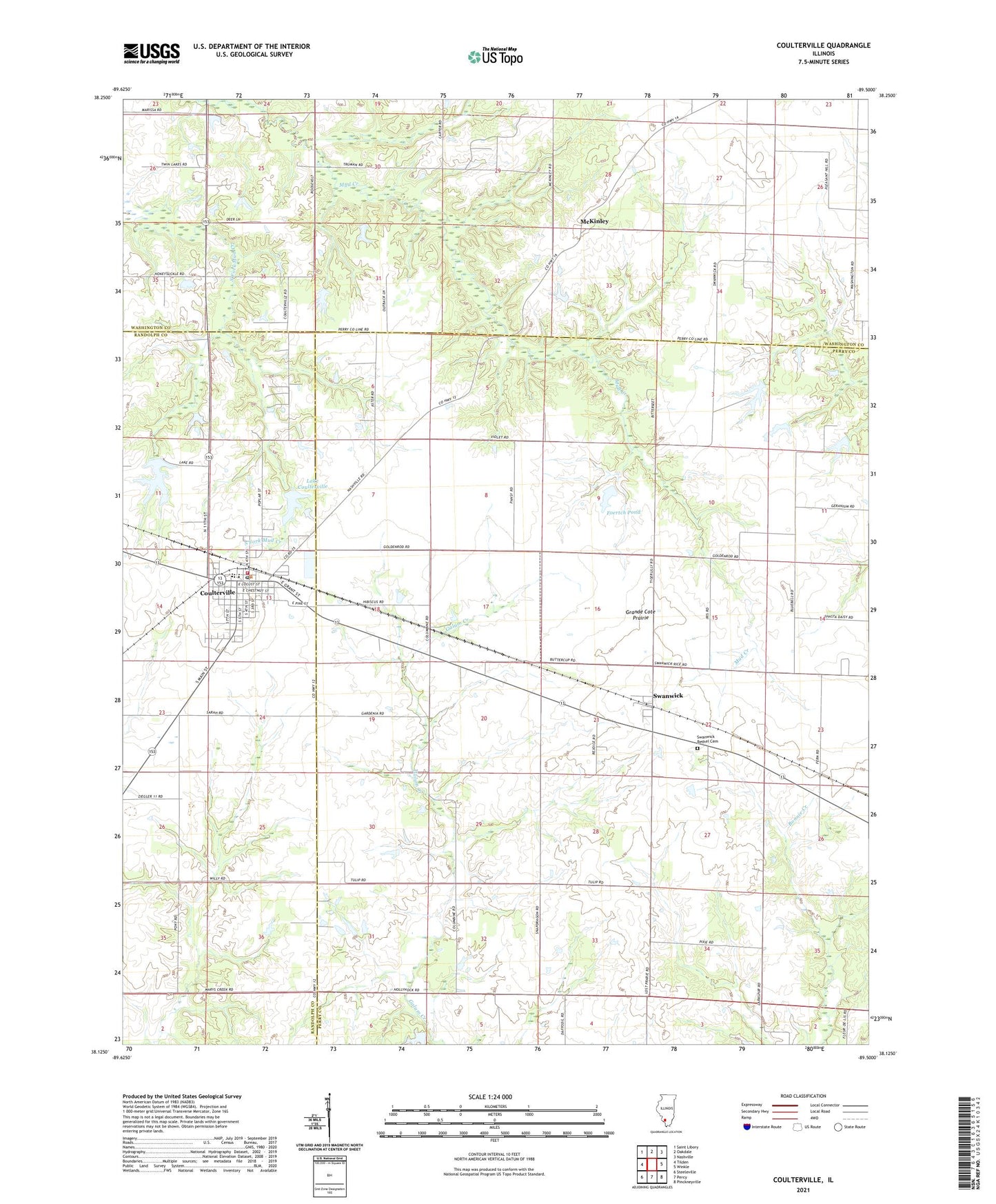
2024 topographic map quadrangle Coulterville in the state of Illinois. Scale: 1:24000. Based on the newly updated USGS 7.5' US Topo map series, this map is in the following counties: Perry, Washington, Randolph. The map contains contour data, water features, and other items you are used to seeing on USGS maps, but also has updated roads and other features. This is the next generation of topographic maps. Printed on high-quality waterproof paper with UV fade-resistant inks.
Quads adjacent to this one:
West: Tilden
Northwest: Saint Libory
North: Oakdale
Northeast: Nashville
East: Winkle
Southeast: Pinckneyville
South: Percy
Southwest: Steeleville
This map covers the same area as the classic USGS quad with code o38089b5.
Contains the following named places: Acheson School, City Reservoir, City Reservoir Dam, Coulterville, Coulterville Ambulance Service, Coulterville Election Precinct, Coulterville Elementary School, Coulterville Post Office, Coulterville United Methodist Church, Coulterville Volunteer Community Fire Protection District, First Baptist Church, Foertch Pond, Foertch Pond Dam, Franklin School, Grandcote Reformed Presbyterian Church, Grande Cote Prairie, Gravel Hill School, Greenland School, Hurst Aviation Heliport, Ireland School, Lake Coulterville, Lake Coulterville Dam, McKinley, Pleasant Hill School, Swanwick, Swanwick Bethel Cemetery, Swanwick Election Precinct, Swanwick Post Office, Temple School, Village of Coulterville, West Side School, ZIP Code: 62237