MyTopo
Saint Libory Illinois US Topo Map
Couldn't load pickup availability
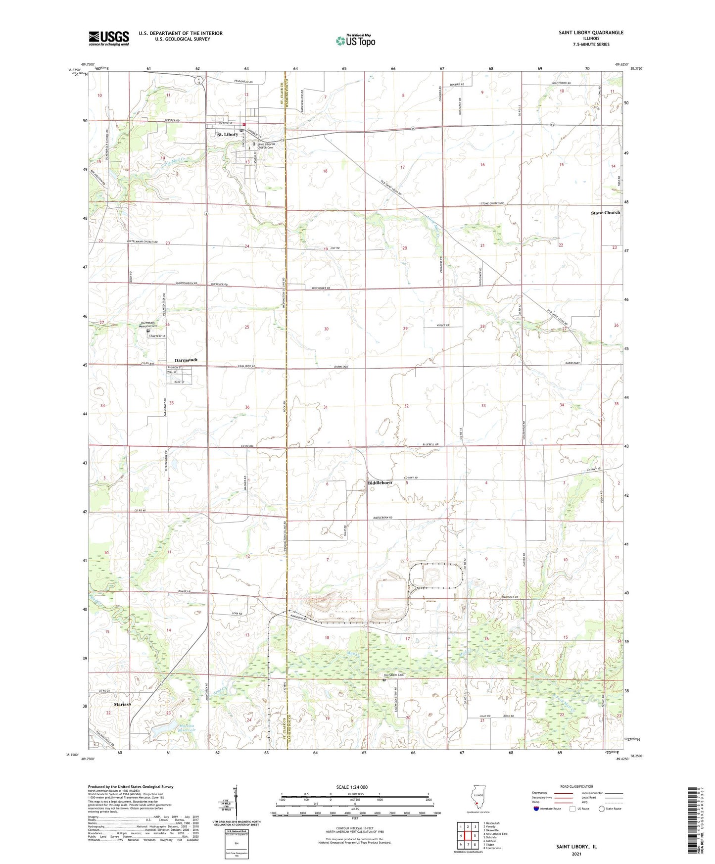
2024 topographic map quadrangle Saint Libory in the state of Illinois. Scale: 1:24000. Based on the newly updated USGS 7.5' US Topo map series, this map is in the following counties: Washington, St. Clair. The map contains contour data, water features, and other items you are used to seeing on USGS maps, but also has updated roads and other features. This is the next generation of topographic maps. Printed on high-quality waterproof paper with UV fade-resistant inks.
Quads adjacent to this one:
West: New Athens East
Northwest: Mascoutah
North: Venedy
Northeast: Okawville
East: Oakdale
Southeast: Coulterville
South: Tilden
Southwest: Baldwin
This map covers the same area as the classic USGS quad with code o38089c6.
Contains the following named places: Biddleborn, Caspars, Caspars Post Office, Darmstadt, Darmstadt Census Designated Place, Darmstadt Memorial Cemetery, Johannisburg Grade School, Lively Grove Townhall, Marissa Reservoir, Marissa Reservoir Dam, Marissa Waterworks, Old Salem Cemetery, Saint Damian Cemetery, Saint Libory, Saint Libory Post Office, Saint Libory Volunteer Fire Department, Shubert Airport, South Fork Mud Creek, Stone Church, Stone Church Post Office, Township of Johannisburg, Township of Lively Grove, Village of Saint Libory, ZIP Codes: 62257, 62282