MyTopo
Oakdale Illinois US Topo Map
Couldn't load pickup availability
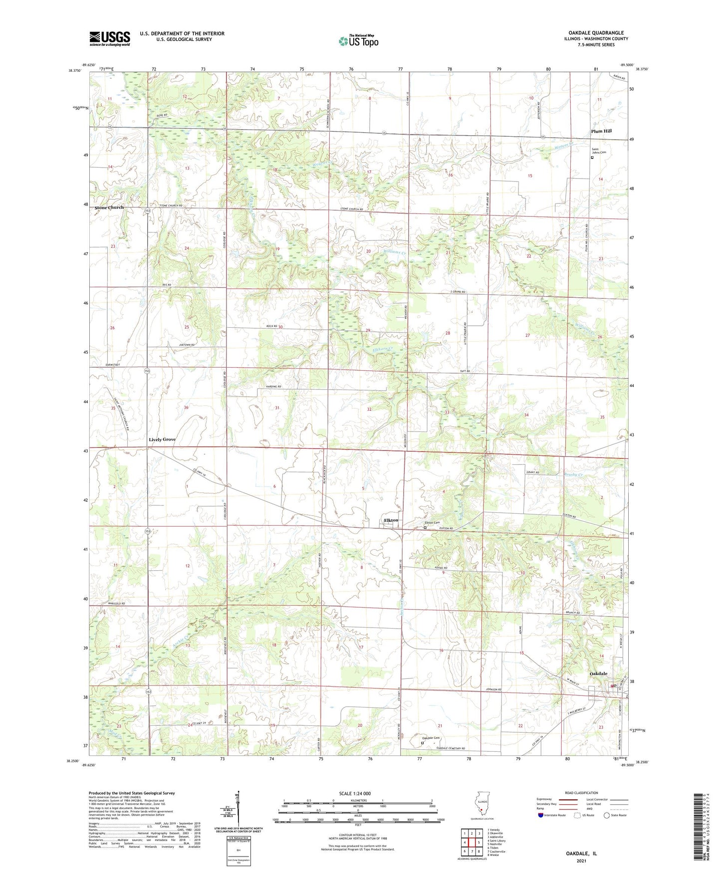
2024 topographic map quadrangle Oakdale in the state of Illinois. Scale: 1:24000. Based on the newly updated USGS 7.5' US Topo map series, this map is in the following counties: Washington. The map contains contour data, water features, and other items you are used to seeing on USGS maps, but also has updated roads and other features. This is the next generation of topographic maps. Printed on high-quality waterproof paper with UV fade-resistant inks.
Quads adjacent to this one:
West: Saint Libory
Northwest: Venedy
North: Okawville
Northeast: Addieville
East: Nashville
Southeast: Winkle
South: Coulterville
Southwest: Tilden
This map covers the same area as the classic USGS quad with code o38089c5.
Contains the following named places: Archie Creek, Brushy Creek, Coulterville Fire Protection District, Elkton, Elkton Cemetery, Lanes Lake, Lanes Lake Dam, Lively Grove, Oakdale, Oakdale Cemetery, Oakdale Community Consolidated Elementary School, Oakdale Post Office, Plum Hill, Saint Anthonys Church, Saint Johns Cemetery, Township of Oakdale, Township of Plum Hill, Village of Oakdale, Weaver Creek, Williams Creek, ZIP Code: 62268