MyTopo
Winkle Illinois US Topo Map
Couldn't load pickup availability
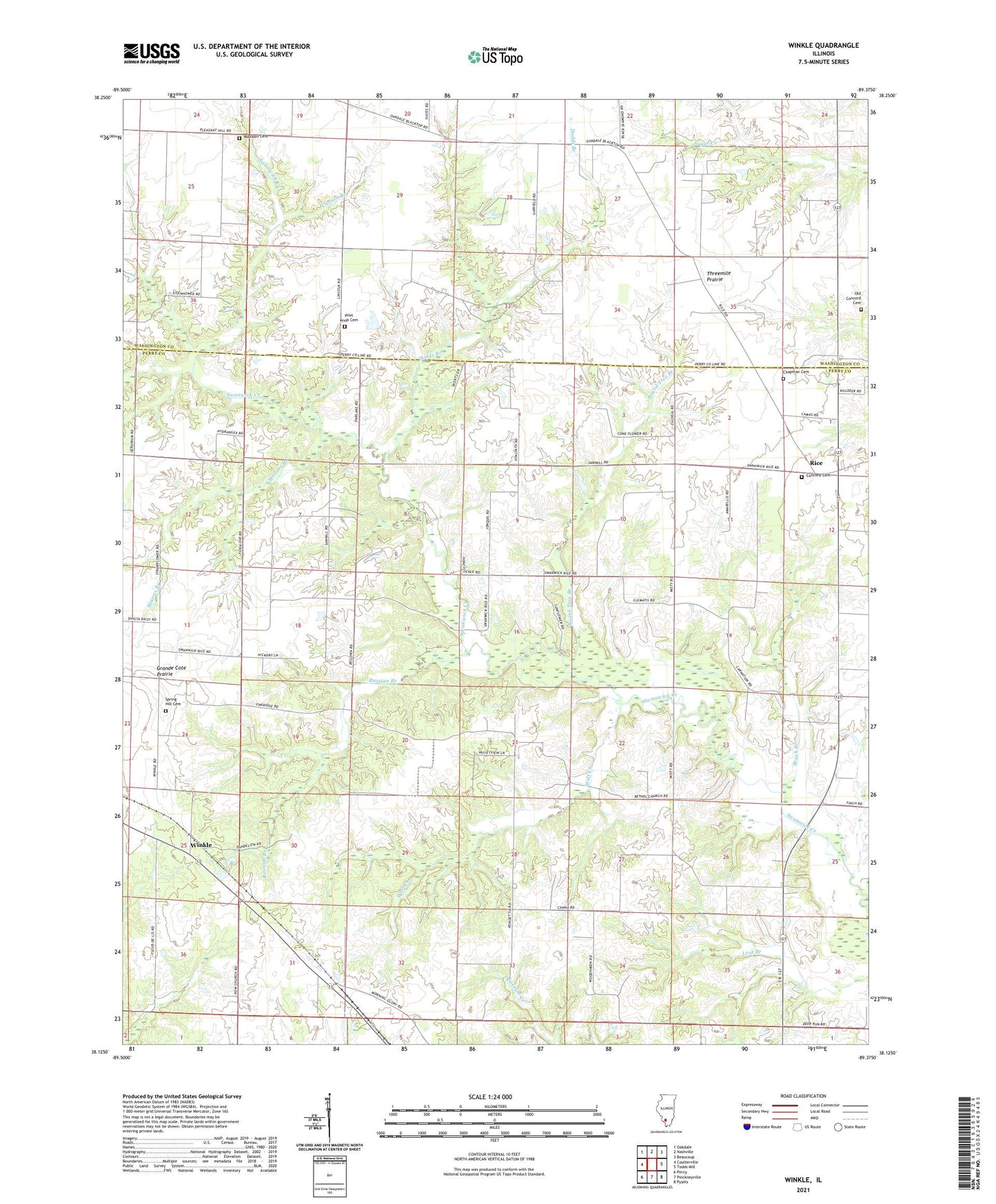
2024 topographic map quadrangle Winkle in the state of Illinois. Scale: 1:24000. Based on the newly updated USGS 7.5' US Topo map series, this map is in the following counties: Perry, Washington. The map contains contour data, water features, and other items you are used to seeing on USGS maps, but also has updated roads and other features. This is the next generation of topographic maps. Printed on high-quality waterproof paper with UV fade-resistant inks.
Quads adjacent to this one:
West: Coulterville
Northwest: Oakdale
North: Nashville
Northeast: Beaucoup
East: Todds Mill
Southeast: Pyatts
South: Pinckneyville
Southwest: Percy
This map covers the same area as the classic USGS quad with code o38089b4.
Contains the following named places: Bethel Church, Board Tree Branch, Brush Branch, Carson Branch, Chapman Cemetery, Concord Cemetery, Dodds Branch, Duncan School, Eichholz School, Kellerman School, Luney School, Maxwell Cemetery, Moores Branch, Old Concord Cemetery, Pilot Knob Cemetery, Pinckneyville Number 8 Election Precinct, Pleasant Grove School, Rice, Russian Branch, School Number 212, Schumaier RLA Airport, Slade School, Spring Hill Cemetery, Threemile Prairie, Winkle, Wolf Creek, Wylie School