MyTopo
Clifton Illinois US Topo Map
Couldn't load pickup availability
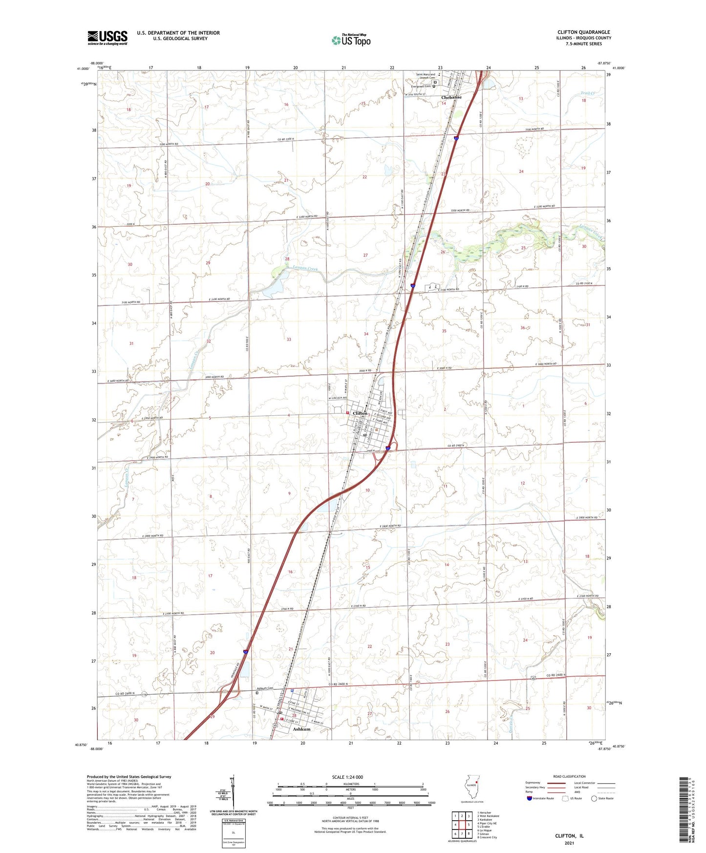
2024 topographic map quadrangle Clifton in the state of Illinois. Scale: 1:24000. Based on the newly updated USGS 7.5' US Topo map series, this map is in the following counties: Iroquois. The map contains contour data, water features, and other items you are used to seeing on USGS maps, but also has updated roads and other features. This is the next generation of topographic maps. Printed on high-quality waterproof paper with UV fade-resistant inks.
Quads adjacent to this one:
West: Piper City NE
Northwest: Herscher
North: West Kankakee
Northeast: Kankakee
Southeast: Crescent City
South: Gilman
Southwest: La Hogue
This map covers the same area as the classic USGS quad with code o40087h8.
Contains the following named places: Ashkum, Ashkum Elementary School, Ashkum Post Office, Ashkum Township Fire Protection District, Ashkum United Methodist Church, Brown School, Central High School, Chebanse Elementary School, Chebanse Township Rural Fire Protection District, Clifton, Clifton Baptist Church, Clifton Elementary School, Clifton Post Office, Clifton Wesleyan Church, Heller School, Illinois State Police Department District 21, John L Nash Middle School, Leggottville School, Saint Mary and Joseph Cemetery, Saint Mary and Josephs Church, Swival School, Tatro School, Township of Ashkum, Township of Chebanse, Village of Ashkum, Village of Clifton, Zion Lutheran Church, Zion Lutheran Church of Clifton, ZIP Codes: 60911, 60927