MyTopo
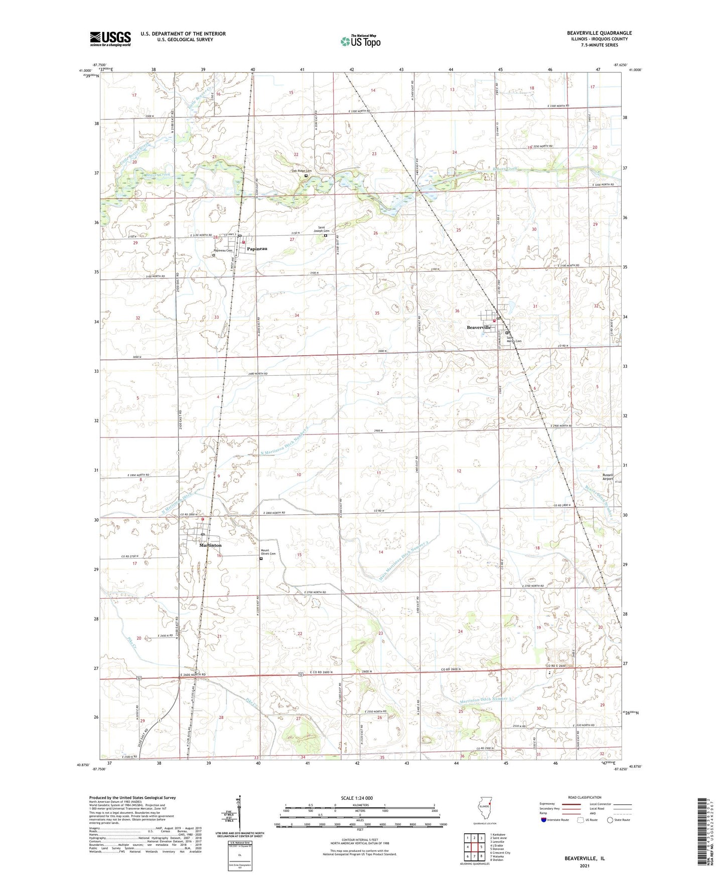
Beaverville Illinois US Topo Map
Couldn't load pickup availability
2024 topographic map quadrangle Beaverville in the state of Illinois. Scale: 1:24000. Based on the newly updated USGS 7.5' US Topo map series, this map is in the following counties: Iroquois. The map contains contour data, water features, and other items you are used to seeing on USGS maps, but also has updated roads and other features. This is the next generation of topographic maps. Printed on high-quality waterproof paper with UV fade-resistant inks.
Quads adjacent to this one:
Northwest: Kankakee
North: Saint Anne
Northeast: Leesville
East: Donovan
Southeast: Sheldon
South: Watseka
Southwest: Crescent City
This map covers the same area as the classic USGS quad with code o40087h6.
Contains the following named places: Beaverville, Beaverville Fire Protection District, Beaverville Post Office, Benoit School, Gagnon School, Jarvis School, Little Beaver Creek, Main Martinton Ditch Number 3, Martinton, Martinton Ditch Number 3, Martinton Fire Protection District, Martinton Post Office, Mount Olivet Cemetery, North Martinton Ditch Number 2, Nourie School, Oak Bank School, Oak Ridge Cemetery, Papineau, Papineau Cemetery, Papineau Fire Protection District, Papineau Post Office, Regnier School, Saint Joseph Cemetery, Saint Mary's Cemetery, Township of Martinton, Township of Papineau, Village of Beaverville, Village of Martinton, Village of Papineau, Weygandt School