MyTopo
Delavan South Illinois US Topo Map
Couldn't load pickup availability
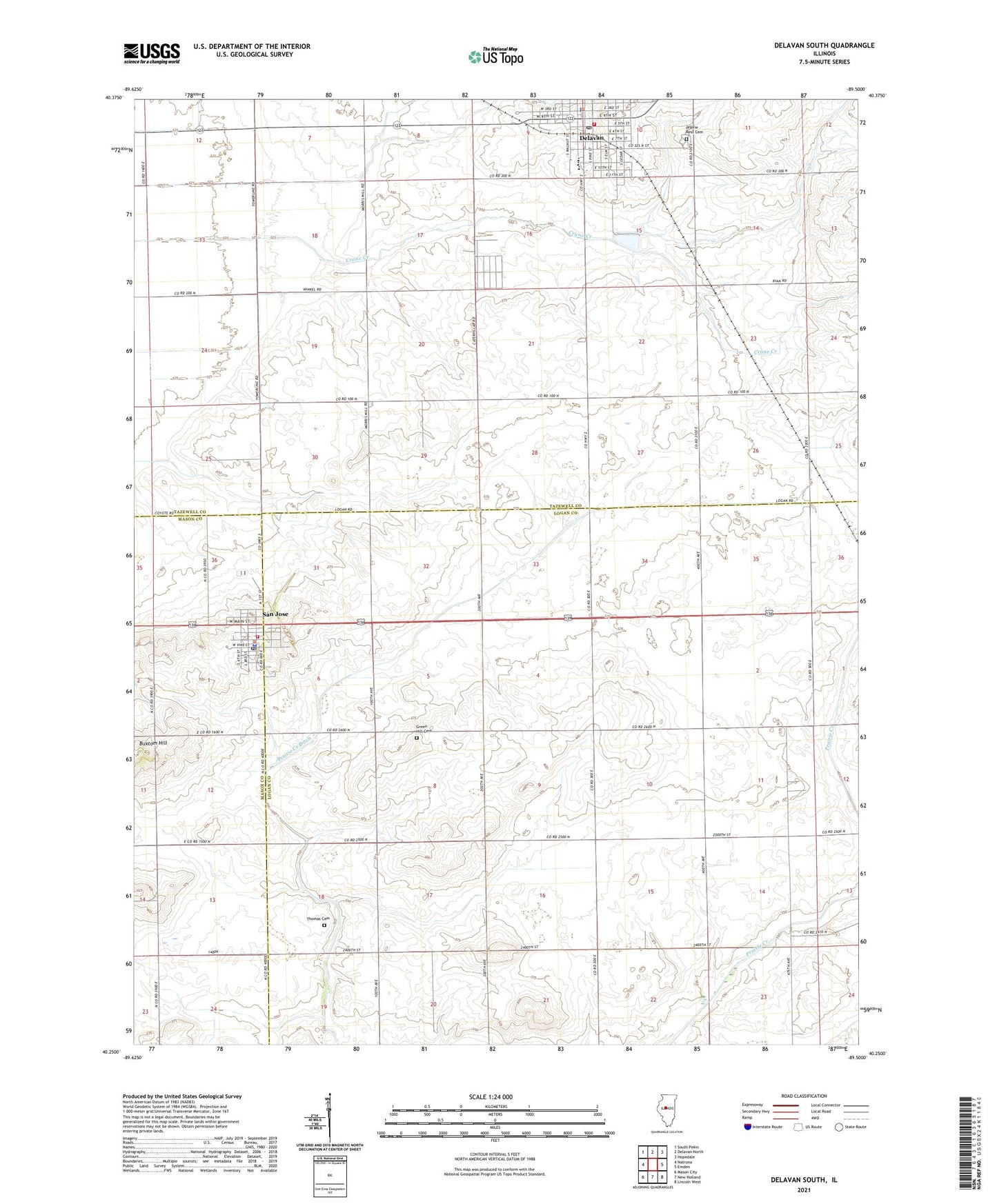
2024 topographic map quadrangle Delavan South in the state of Illinois. Scale: 1:24000. Based on the newly updated USGS 7.5' US Topo map series, this map is in the following counties: Logan, Tazewell, Mason. The map contains contour data, water features, and other items you are used to seeing on USGS maps, but also has updated roads and other features. This is the next generation of topographic maps. Printed on high-quality waterproof paper with UV fade-resistant inks.
Quads adjacent to this one:
West: Natrona
Northwest: South Pekin
North: Delavan North
Northeast: Hopedale
East: Emden
Southeast: Lincoln West
South: New Holland
Southwest: Mason City
This map covers the same area as the classic USGS quad with code o40089c5.
Contains the following named places: Buxtom Hill, City of Delavan, Crane Creek, Cream Ridge School, Delavan, Delavan Ambulance Service, Delavan Fire Protection District, Delavan High School, Delavan Police Department, Delavan Post Office, Elder Grove School, Green Hill Cemetery, Home School, Liberty School, Neibuhr School, Pawson School, Pleasant View School, Prairie Creek Ditch, Prairie Rest Cemetery, San Jose, San Jose Fire Protection District, San Jose Police Department, San Jose Post Office, Thomas Cemetery, Township of Delavan, Township of Prairie Creek, Victory School, Village of San Jose, Zoar School