MyTopo
South Pekin Illinois US Topo Map
Couldn't load pickup availability
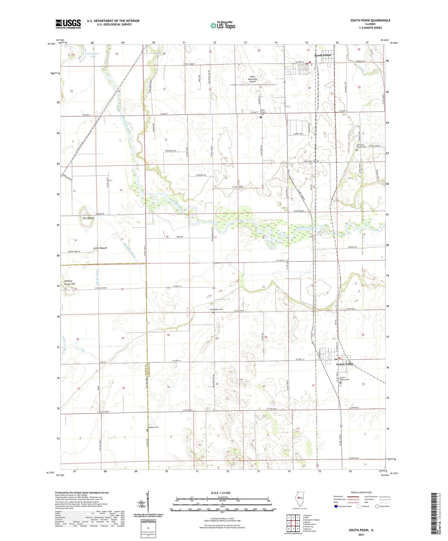
2024 topographic map quadrangle South Pekin in the state of Illinois. Scale: 1:24000. Based on the newly updated USGS 7.5' US Topo map series, this map is in the following counties: Tazewell, Mason. The map contains contour data, water features, and other items you are used to seeing on USGS maps, but also has updated roads and other features. This is the next generation of topographic maps. Printed on high-quality waterproof paper with UV fade-resistant inks.
Quads adjacent to this one:
West: Manito
Northwest: Glasford
North: Pekin
Northeast: Marquette Heights
East: Delavan North
Southeast: Delavan South
South: Natrona
Southwest: Forest City
This map covers the same area as the classic USGS quad with code o40089d6.
Contains the following named places: Bethel Tabernacle, Breedlove Cemetery, Breedlove Ditch, Cleveland Grove School, Eidman School, First Congregational Church, Green Valley, Green Valley Cemetery, Green Valley Fire Department, Green Valley Post Office, Hickory Grove Ditch, Hickory Grove Hill, Hickory Grove School, Horseshoe Lake, Langston Cemetery, Little Mound, Locust Grove School, Malone School, Meeker Ditch, Midwest Central Middle School, Mount Pleasant School, Oak Hill School, Old Sand Prairie Cemetery, Pekin Municipal Airport, Prairie Lawn School, Rogers School, Saint Johns Church, Sand Prairie Cemetery, Sand Prairie Townhall, South Pekin, South Pekin Elementary School, South Pekin Post Office, South Pekin Village Police Department, South Pekin Volunteer Fire Department Station 1, South Pekin Volunteer Fire Department Station 2, The Mound, Township of Sand Prairie, Union Church, Village of Green Valley, Village of South Pekin, ZIP Codes: 61534, 61564