MyTopo
Mason City Illinois US Topo Map
Couldn't load pickup availability
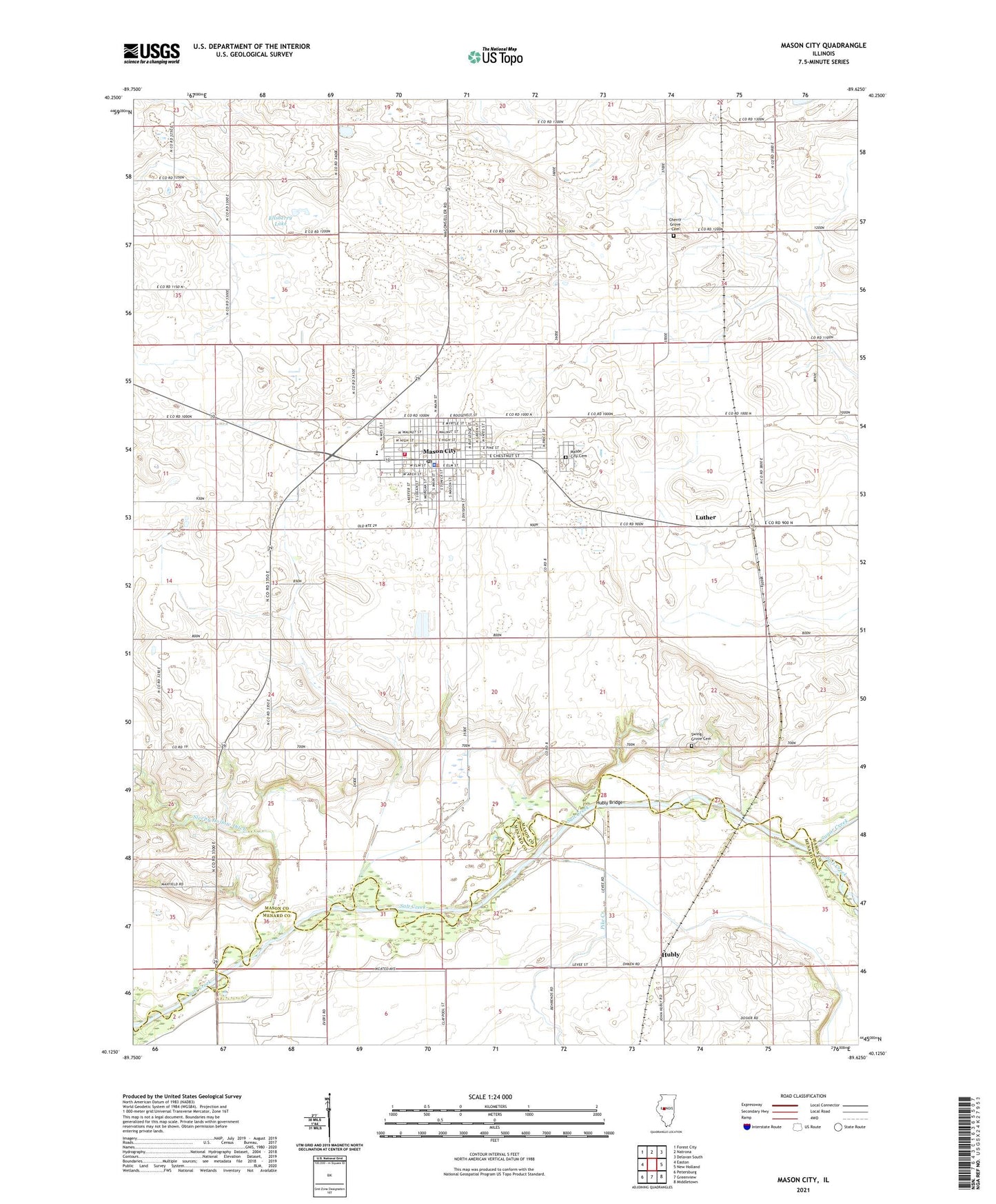
2024 topographic map quadrangle Mason City in the state of Illinois. Scale: 1:24000. Based on the newly updated USGS 7.5' US Topo map series, this map is in the following counties: Mason, Menard. The map contains contour data, water features, and other items you are used to seeing on USGS maps, but also has updated roads and other features. This is the next generation of topographic maps. Printed on high-quality waterproof paper with UV fade-resistant inks.
Quads adjacent to this one:
West: Easton
Northwest: Forest City
North: Natrona
Northeast: Delavan South
East: New Holland
Southeast: Middletown
South: Greenview
Southwest: Petersburg
This map covers the same area as the classic USGS quad with code o40089b6.
Contains the following named places: Cherry Grove Cemetery, Cherry Grove School, Christ Lutheran Church, City of Mason City, Ellsberry Lake, First Baptist Church of Mason City, First Christian Church, Hubly, Hubly Bridge, Illini Central High School, Luther, Mason City, Mason City Cemetery, Mason City City Hall, Mason City Fire Protection District, Mason City Post Office, Mason City United Methodist Church, Mason County Ambulance Service, Mason Police Department, Memorial Park, North Prairie School, Pike Creek, Pleasant View School, Pollock School, Saint Columba Catholic Church, Salt Creek School, Sleepy Hollow Ditch, Sleepy Hollow School, Sugar Creek, Swing Grove Cemetery, Swing Grove School, Tourist Park, Township of Mason City, Wooley School, ZIP Code: 62664