MyTopo
East Lynn Illinois US Topo Map
Couldn't load pickup availability
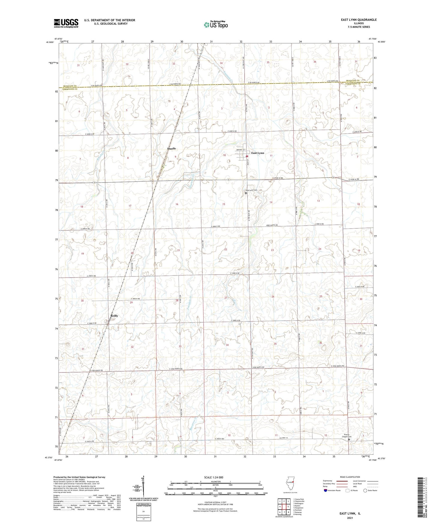
2024 topographic map quadrangle East Lynn in the state of Illinois. Scale: 1:24000. Based on the newly updated USGS 7.5' US Topo map series, this map is in the following counties: Vermilion, Iroquois. The map contains contour data, water features, and other items you are used to seeing on USGS maps, but also has updated roads and other features. This is the next generation of topographic maps. Printed on high-quality waterproof paper with UV fade-resistant inks.
Quads adjacent to this one:
West: Rankin
Northwest: Cissna Park
North: Claytonville
Northeast: Wellington
East: Hoopeston
Southeast: Henning
South: Potomac
Southwest: Penfield
This map covers the same area as the classic USGS quad with code o40087d7.
Contains the following named places: Arnold School, Bratton School, Clark School, East Lynn, East Lynn Cemetery, East Lynn Census Designated Place, East Lynn Post Office, Hustle, Murphy School, Newman School, Peterson School, Pine Grove School, Pleasant Valley School, Prairie Chapel Cemetery, Prairie View Chapel, Rankin Fire Protection District East Lynn, Reilly, Russells Airport, Schwartz Church, Science Hill School, Township of Butler, ZIP Code: 60932