MyTopo
Potomac Illinois US Topo Map
Couldn't load pickup availability
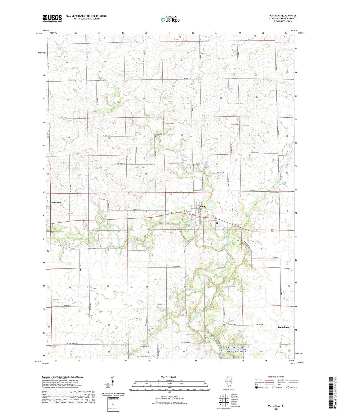
2024 topographic map quadrangle Potomac in the state of Illinois. Scale: 1:24000. Based on the newly updated USGS 7.5' US Topo map series, this map is in the following counties: Vermilion. The map contains contour data, water features, and other items you are used to seeing on USGS maps, but also has updated roads and other features. This is the next generation of topographic maps. Printed on high-quality waterproof paper with UV fade-resistant inks.
Quads adjacent to this one:
West: Penfield
Northwest: Rankin
North: East Lynn
Northeast: Hoopeston
East: Henning
Southeast: Danville NW
South: Collison
Southwest: Royal
This map covers the same area as the classic USGS quad with code o40087c7.
Contains the following named places: Bass Ford, Bean Creek, Bean Creek School, Biddle School, Blue Grass, Bluegrass Creek, Bluegrass Fire Protection District, Bluegrass School, City Park, Covenant High School, Gray Ford, Green Valley School, Hawbuck School, Ingersoll Cemetery, Knights Branch, Knight's Branch Cemetery, Knights Branch School, Middle Fork State Fish and Wildlife Areas, Middlefork Ambulance Service, Number Ten Church, Old Partlow Cemetery, Potomac, Potomac Cemetery, Potomac Elementary School, Potomac Post Office, School Number 10, Selsor Ford, Tillotson School, Township of Middlefork, Village of Potomac, Wallace Chapel, Wallace Chapel Cemetery, Williams School, Wise School, ZIP Code: 61865