MyTopo
Enfield Illinois US Topo Map
Couldn't load pickup availability
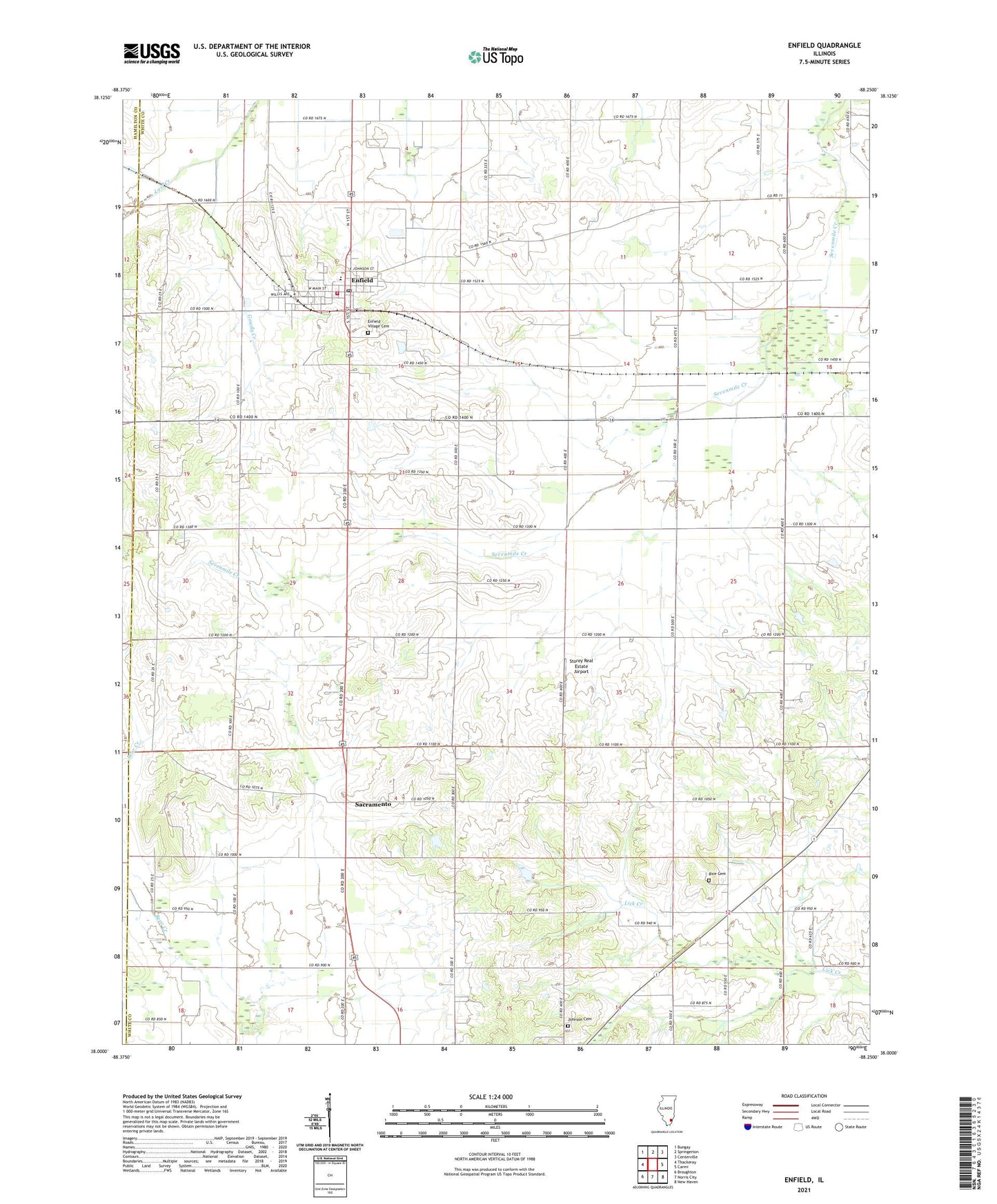
2024 topographic map quadrangle Enfield in the state of Illinois. Scale: 1:24000. Based on the newly updated USGS 7.5' US Topo map series, this map is in the following counties: White, Hamilton. The map contains contour data, water features, and other items you are used to seeing on USGS maps, but also has updated roads and other features. This is the next generation of topographic maps. Printed on high-quality waterproof paper with UV fade-resistant inks.
Quads adjacent to this one:
West: Thackeray
Northwest: Bungay
North: Springerton
Northeast: Centerville
East: Carmi
Southeast: New Haven
South: Norris City
Southwest: Broughton
This map covers the same area as the classic USGS quad with code o38088a3.
Contains the following named places: Bethel Church, Booth Elementary School, Brockett School, Enfield, Enfield Fire Department, Enfield Post Office, Enfield Village Cemetery, Gowdy Creek, Hickory Valley School, Jamestown, Johnson Cemetery, Modoc School, Murdach School, Rice Cemetery, Roland Oil Field, Sacramento, Saint Patricks Church, Sharon Church, Smith School, Stephens School, Stokes, Storey Real Estate Airport, Township of Enfield, Trousdale School, Trumbull Oil Field, Upponblock School, Veatch School, Village of Enfield, Wesley Chapel, West Point School, West Union Church, ZIP Code: 62835