MyTopo
Eureka Illinois US Topo Map
Couldn't load pickup availability
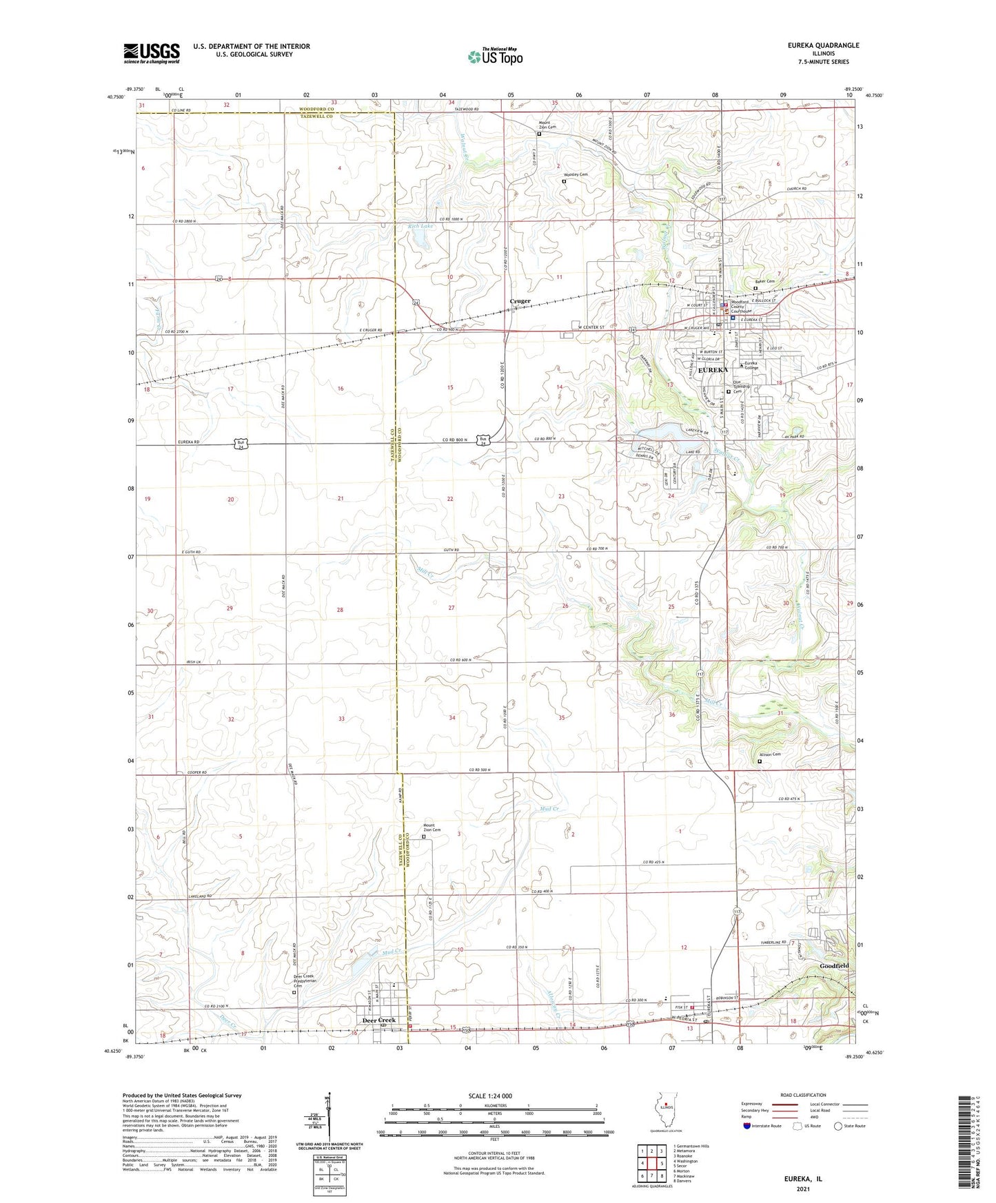
2024 topographic map quadrangle Eureka in the state of Illinois. Scale: 1:24000. Based on the newly updated USGS 7.5' US Topo map series, this map is in the following counties: Woodford, Tazewell. The map contains contour data, water features, and other items you are used to seeing on USGS maps, but also has updated roads and other features. This is the next generation of topographic maps. Printed on high-quality waterproof paper with UV fade-resistant inks.
Quads adjacent to this one:
West: Washington
Northwest: Germantown Hills
North: Metamora
Northeast: Roanoke
East: Secor
Southeast: Danvers
South: Mackinaw
Southwest: Morton
This map covers the same area as the classic USGS quad with code o40089f3.
Contains the following named places: Advocate Eureka Hospital, Allison Cemetery, Baker Cemetery, City of Eureka, Cottonwood School, Cruger, Danforth School, Davenport Elementary School, Dee-Mack Middle School, Deer Creek, Deer Creek Fire Protection District, Deer Creek Post Office, Deer Creek Presbyterian Cemetery, Enchanted Gardens Mobile Home Park, Eureka, Eureka - Goodfield Fire Protection District Eureka Station, Eureka - Goodfield Fire Protection District Goodfield Station, Eureka College, Eureka High School, Eureka Lake, Eureka Lake Dam, Eureka Middle School, Eureka Police Department, Eureka Post Office, Galey School, Goodfield, Goodfield Post Office, Greenridge School, Liberty Bible Church, Mill Creek, Mount Zion Cemetery, Olio School, Olio Township Cemetery, Our Redeemer Church, Pleasant View School, Pleasantland Farm, Ray School, Reed School, Rich Lake, Rich Lake Dam, Stormer School, Township of Cruger, Village of Deer Creek, Village of Goodfield, WCRI-FM (Eureka), Woodford County Courthouse, Woodford County Sheriff's Office, Woosley Cemetery, ZIP Codes: 61530, 61742