MyTopo
Roanoke Illinois US Topo Map
Couldn't load pickup availability
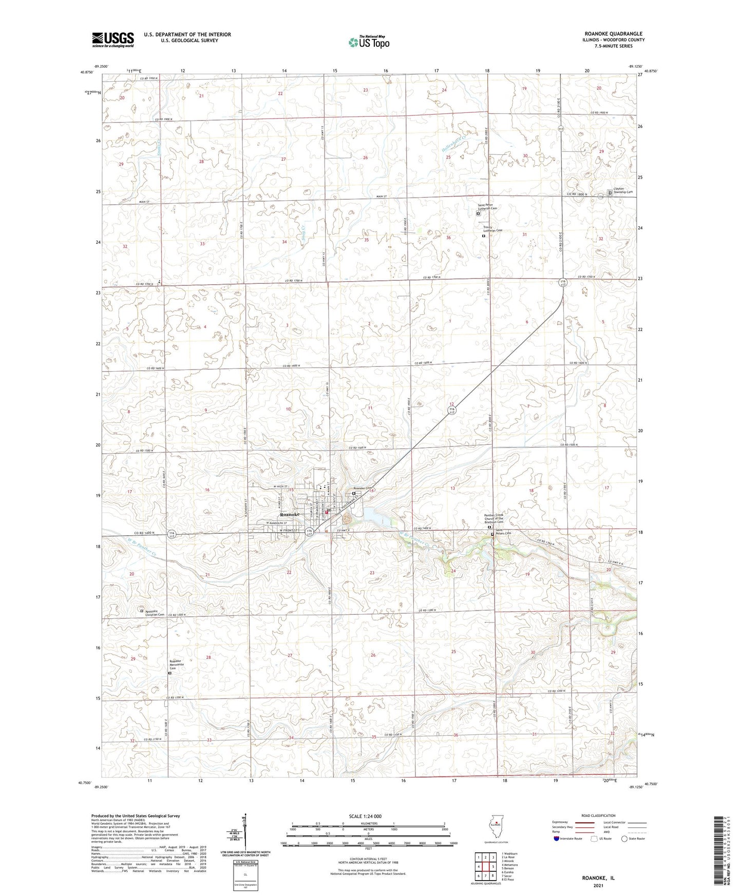
2024 topographic map quadrangle Roanoke in the state of Illinois. Scale: 1:24000. Based on the newly updated USGS 7.5' US Topo map series, this map is in the following counties: Woodford. The map contains contour data, water features, and other items you are used to seeing on USGS maps, but also has updated roads and other features. This is the next generation of topographic maps. Printed on high-quality waterproof paper with UV fade-resistant inks.
Quads adjacent to this one:
West: Metamora
Northwest: Washburn
North: La Rose
Northeast: Minonk
East: Benson
Southeast: El Paso
South: Secor
Southwest: Eureka
This map covers the same area as the classic USGS quad with code o40089g2.
Contains the following named places: Apostolic Christian Cemetery, Apostolic Church, Brethren Church, Clayton Township Cemetery, Linn Mennonite Church, Mennonite Church, Panther Creek Church of the Brethren Cemetery, Pineline Farms, Roanoke, Roanoke Cemetery, Roanoke Fire Protection District, Roanoke Mennonite Cemetery, Roanoke Municipal Ambulance Department, Roanoke United Methodist Church, Roanoke-Benson High School, Saint Joseph's Catholic Church, Saint Peter Lutheran Cemetery, Saint Peter Lutheran Church, Saint Peters Cemetery, Scherer Landing Strip, Sowers Elementary School, Township of Roanoke, Trinity Lutheran Cemetery, Trinity Lutheran Church, Village of Roanoke, Woodford County, ZIP Codes: 61516, 61561