MyTopo
Metamora Illinois US Topo Map
Couldn't load pickup availability
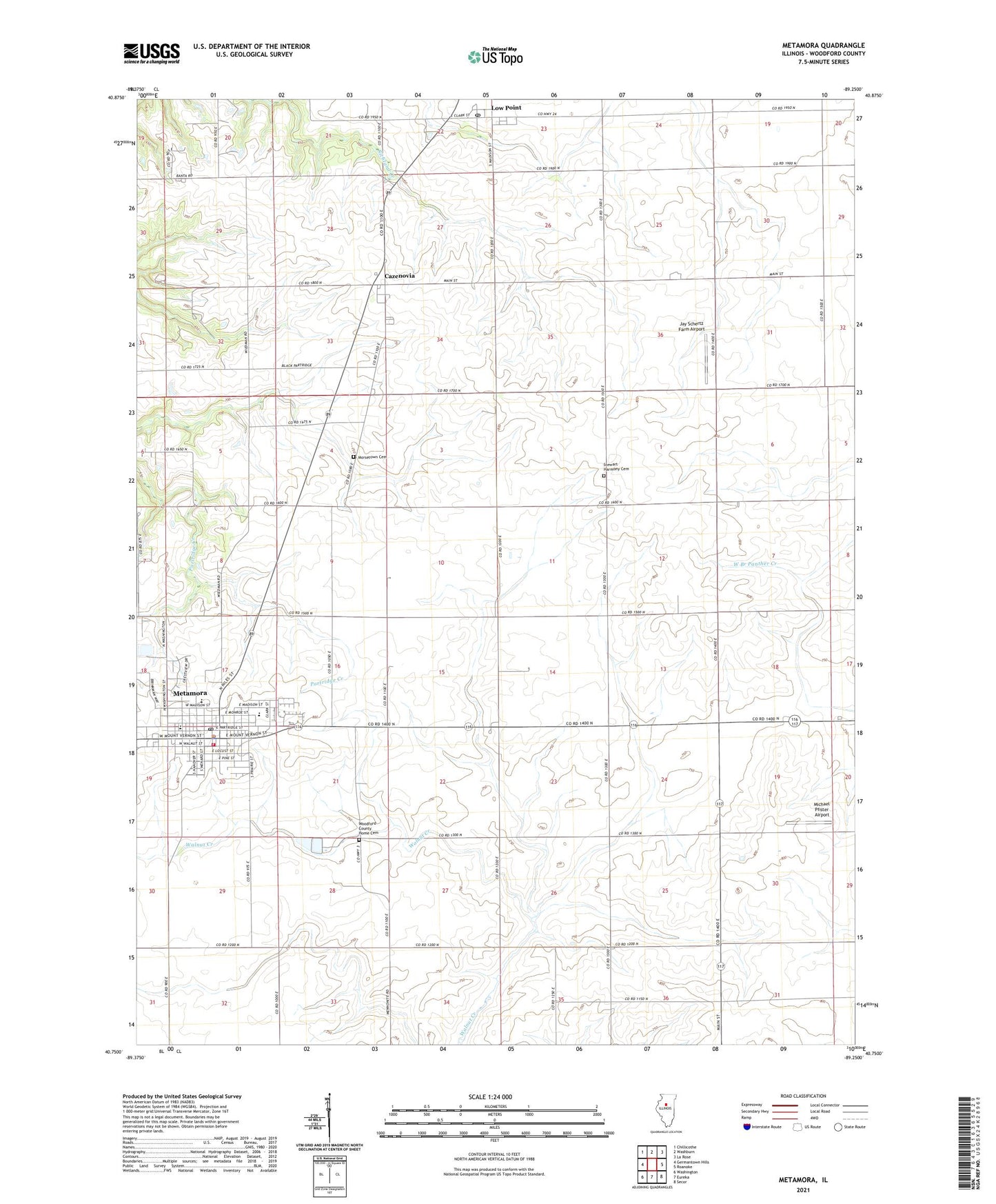
2024 topographic map quadrangle Metamora in the state of Illinois. Scale: 1:24000. Based on the newly updated USGS 7.5' US Topo map series, this map is in the following counties: Woodford. The map contains contour data, water features, and other items you are used to seeing on USGS maps, but also has updated roads and other features. This is the next generation of topographic maps. Printed on high-quality waterproof paper with UV fade-resistant inks.
Quads adjacent to this one:
West: Germantown Hills
Northwest: Chillicothe
North: Washburn
Northeast: La Rose
East: Roanoke
Southeast: Secor
South: Eureka
Southwest: Washington
This map covers the same area as the classic USGS quad with code o40089g3.
Contains the following named places: Camp Manitoumi, Cazenovia, Cazenovia Post Office, Emergency 116 Ambulance Service, Fairview School, First Baptist Church, Happy Hour School, Harmony School, Hazel Dell School, Jay Schertz Farm Airport, Lincoln School, Lone Willow Farm, Low Point, Lowell School, Lowpoint Census Designated Place, Lowpoint Post Office, Maple Grove School, Maple Lawn School, Metamora, Metamora City Hall, Metamora Courthouse, Metamora Grade School, Metamora High School, Metamora Post Office, Metamora Township Police Department, Metamora Volunteer Fire Department, Michael Pfister Airport, Morristown School, Morsetown Cemetery, Mount Pleasant School, Oak Dell School, Pleasant Valley School, Saint Marys Friary, Saint Marys School, Stewart Harmony Cemetery, Tom School, Township of Metamora, Village of Metamora, Woodford County Home, Woodford County Home Cemetery, ZIP Code: 61545