MyTopo
Flanagan South Illinois US Topo Map
Couldn't load pickup availability
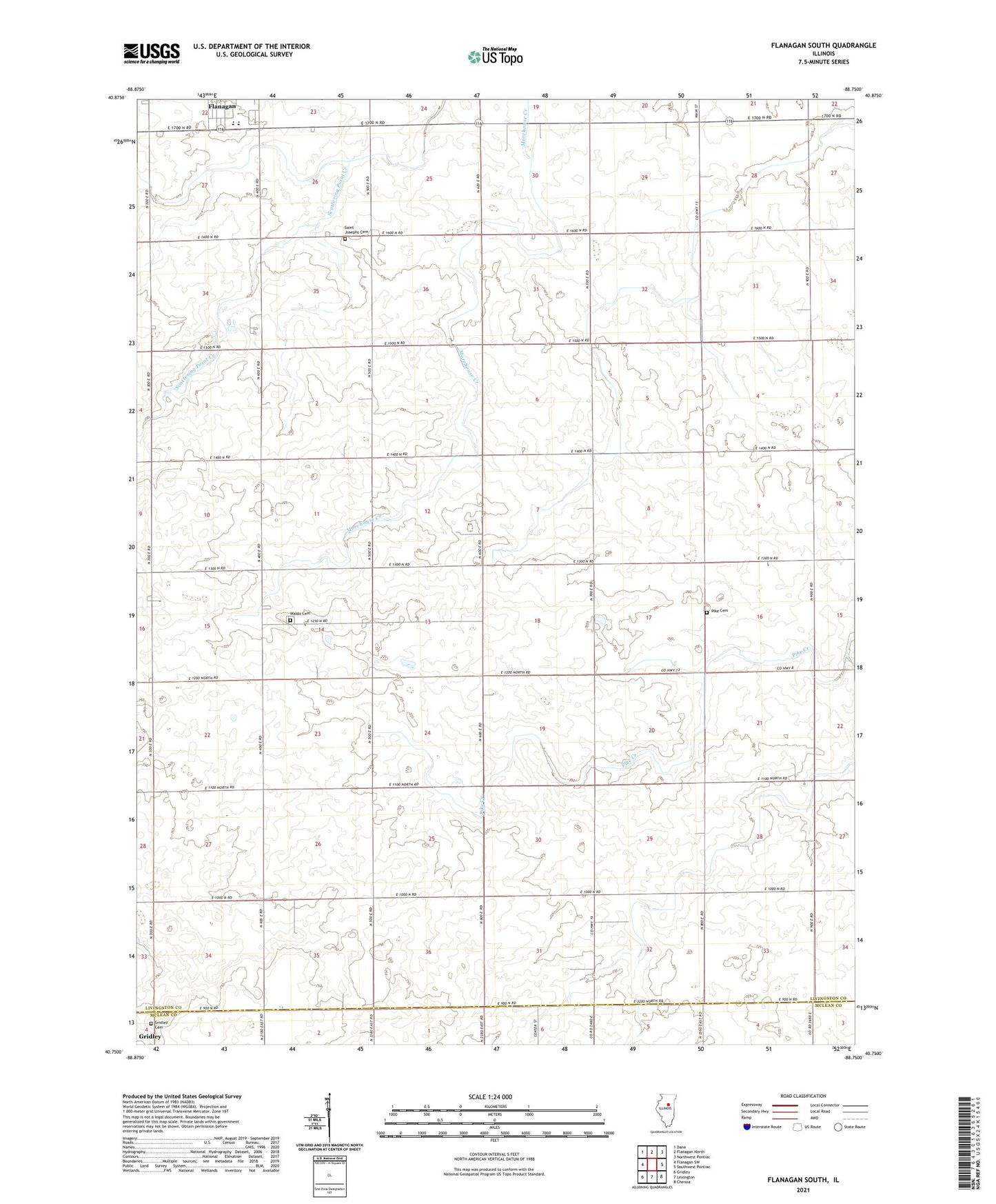
2024 topographic map quadrangle Flanagan South in the state of Illinois. Scale: 1:24000. Based on the newly updated USGS 7.5' US Topo map series, this map is in the following counties: Livingston, McLean. The map contains contour data, water features, and other items you are used to seeing on USGS maps, but also has updated roads and other features. This is the next generation of topographic maps. Printed on high-quality waterproof paper with UV fade-resistant inks.
Quads adjacent to this one:
West: Flanagan SW
Northwest: Dana
North: Flanagan North
Northeast: Northwest Pontiac
East: Southwest Pontiac
Southeast: Chenoa
South: Lexington
Southwest: Gridley
This map covers the same area as the classic USGS quad with code o40088g7.
Contains the following named places: Flanagan Church, Flanagan High School, Gridley Cemetery, Pike Cemetery, Saint Josephs Cemetery, Salem Childrens Home, Salem Evangelical Mennonite Church, Salem Park, Slagel Strip, Township of Pike, Township of Waldo, Waldo, Waldo Cemetery, Waldo Church