MyTopo
Southwest Pontiac Illinois US Topo Map
Couldn't load pickup availability
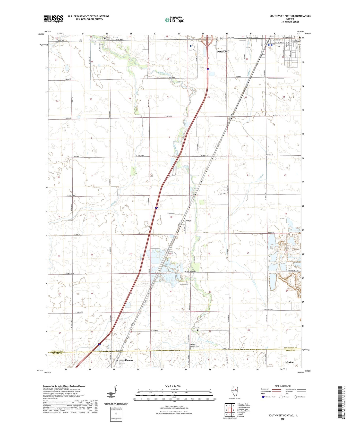
2024 topographic map quadrangle Southwest Pontiac in the state of Illinois. Scale: 1:24000. Based on the newly updated USGS 7.5' US Topo map series, this map is in the following counties: Livingston, McLean. The map contains contour data, water features, and other items you are used to seeing on USGS maps, but also has updated roads and other features. This is the next generation of topographic maps. Printed on high-quality waterproof paper with UV fade-resistant inks.
Quads adjacent to this one:
West: Flanagan South
Northwest: Flanagan North
North: Northwest Pontiac
Northeast: Northeast Pontiac
East: Southeast Pontiac
Southeast: Fairbury
South: Chenoa
Southwest: Lexington
This map covers the same area as the classic USGS quad with code o40088g6.
Contains the following named places: Calvary Catholic Cemetery, Center School, Dillon Quarry, East Quarry, Eppards Point Church, Eppards Point Townhall, Fairview School, Hancock School, Harris Landing Strip, Holmes School, Humiston Park, Illinois State Police Department District 6, Lammatch School, Laycock School, Lincoln Elementary School, Livingston County Home, Livingston County Jail, Livingston County Sheriff's Office, McDowell Quarry, Ocoya, Ocoya School, Order of Saint Francis Saint James Hospital - John Albrecht Medical Center, Payne Cemetery, Pike Creek, Pleasant View School, Pontiac Correctional Center, Pontiac Southside Cemetery, Raymond Schultz Round Barn, Reeds School, Rooks Creek Cemetery, Rooks Creek School, Rooks Creek United Methodist Church, Seeman Airport, Sunnydale School, Township of Eppards Point, Turtle Creek School