MyTopo
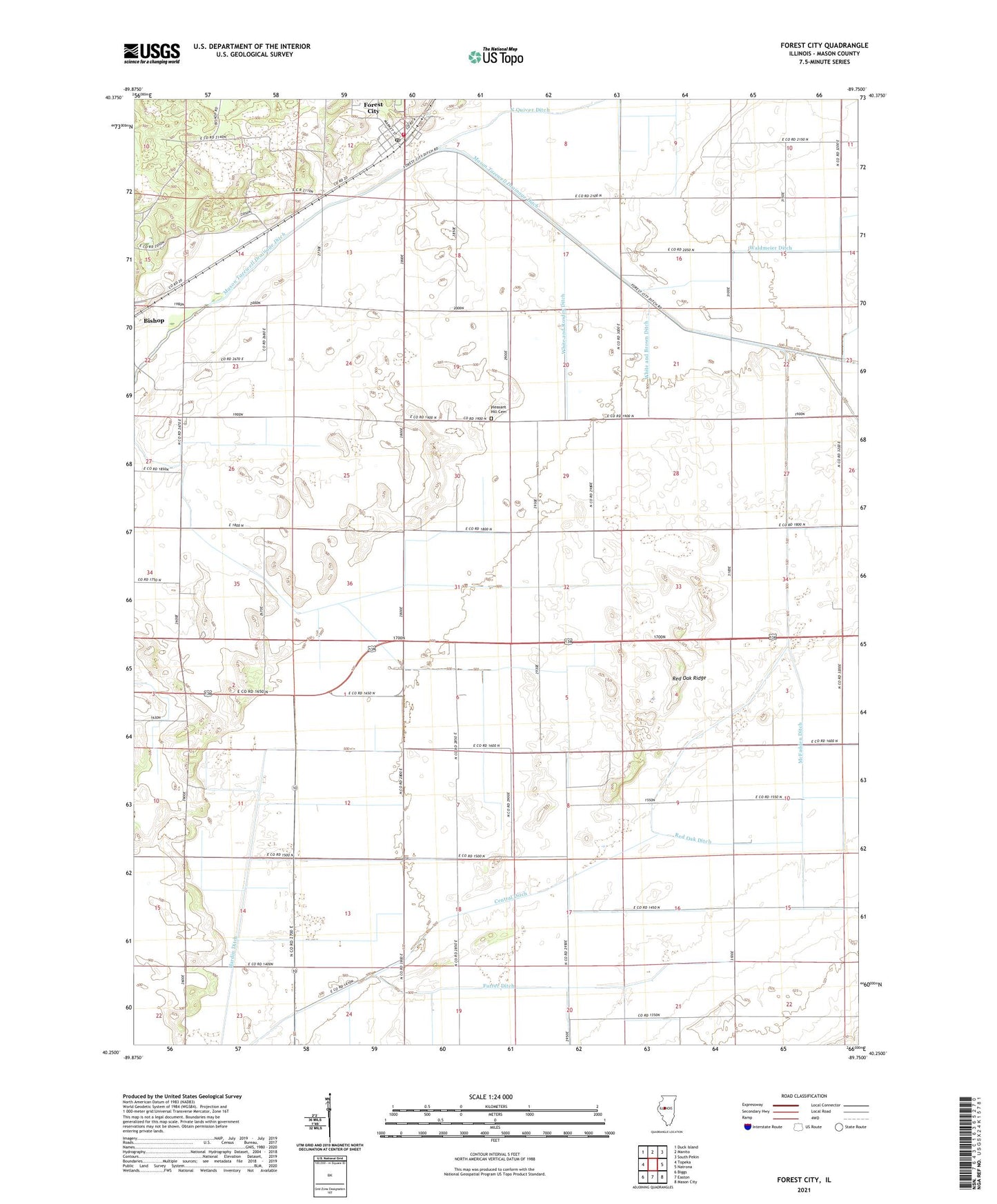
Forest City Illinois US Topo Map
Couldn't load pickup availability
2024 topographic map quadrangle Forest City in the state of Illinois. Scale: 1:24000. Based on the newly updated USGS 7.5' US Topo map series, this map is in the following counties: Mason. The map contains contour data, water features, and other items you are used to seeing on USGS maps, but also has updated roads and other features. This is the next generation of topographic maps. Printed on high-quality waterproof paper with UV fade-resistant inks.
Quads adjacent to this one:
West: Topeka
Northwest: Duck Island
North: Manito
Northeast: South Pekin
East: Natrona
Southeast: Mason City
South: Easton
Southwest: Biggs
This map covers the same area as the classic USGS quad with code o40089c7.
Contains the following named places: Beck School, Bishop, Brown School, Central Ditch, Forest City, Forest City Post Office, Forman Fire Protection District Station 2 Forest City, Furrer Ditch, Golden Valley School, Hardin Ditch, Kreilings Airport, Lake Shore School, McFadden Ditch, Pennsylvania Lane School, Pleasant Hill Cemetery, Red Oak Ditch, Red Oak Ridge, Red Oak School, Roos Ditch, Spaits School, Township of Forest City, Township of Pennsylvania, Union School, Union School Number 1, Village of Forest City, Waldmeier Ditch, Wessling School, White and Brown Ditch, White and Rowley Ditch, White School, ZIP Code: 61532