MyTopo
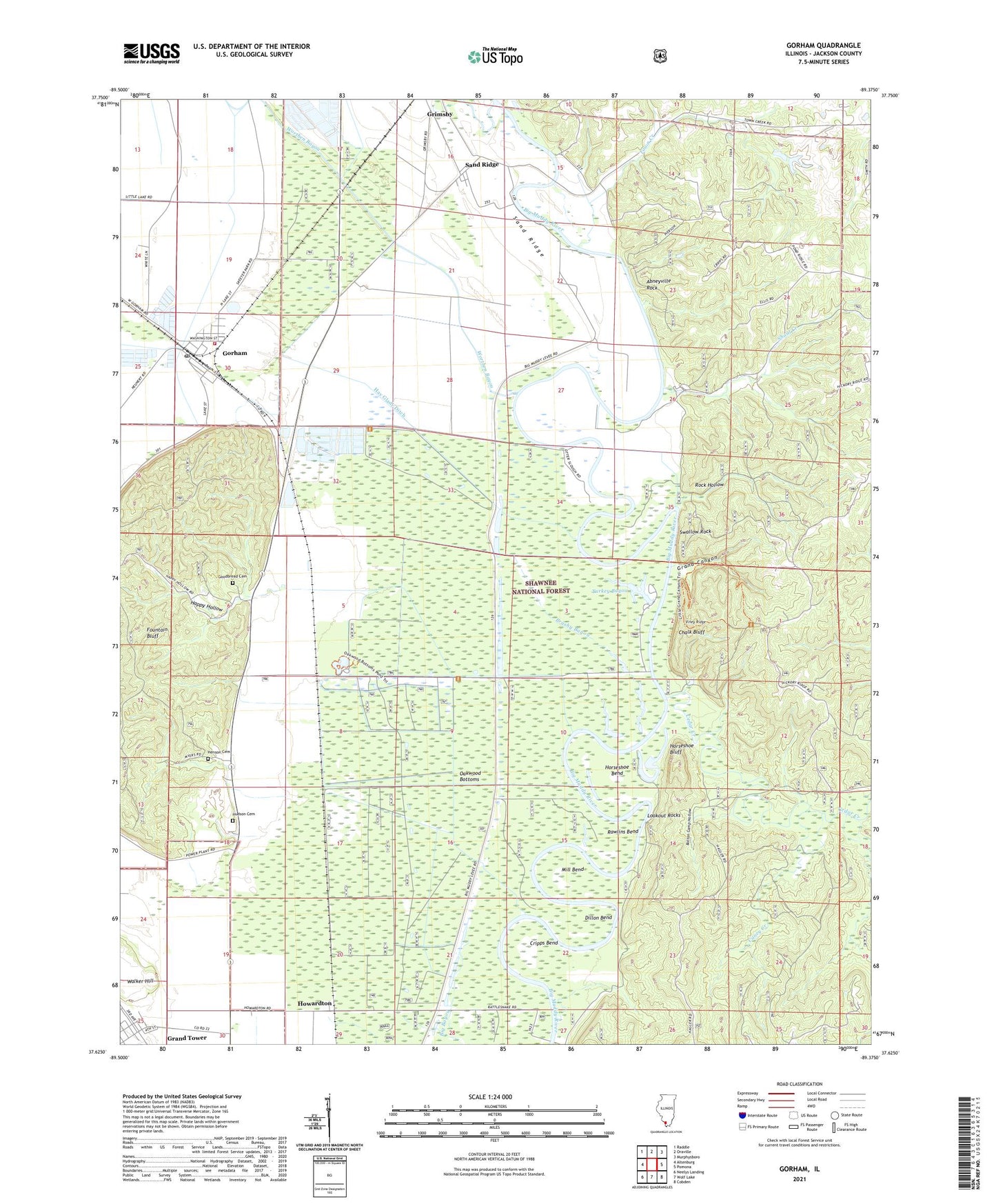
Gorham Illinois US Topo Map
Couldn't load pickup availability
Also explore the Gorham Forest Service Topo of this same quad for updated USFS data
2024 topographic map quadrangle Gorham in the state of Illinois. Scale: 1:24000. Based on the newly updated USGS 7.5' US Topo map series, this map is in the following counties: Jackson. The map contains contour data, water features, and other items you are used to seeing on USGS maps, but also has updated roads and other features. This is the next generation of topographic maps. Printed on high-quality waterproof paper with UV fade-resistant inks.
Quads adjacent to this one:
West: Altenburg
Northwest: Raddle
North: Oraville
Northeast: Murphysboro
East: Pomona
Southeast: Cobden
South: Wolf Lake
Southwest: Neelys Landing
This map covers the same area as the classic USGS quad with code o37089f4.
Contains the following named places: Abneyville Rock, Bolton Camp Hollow, Brushy Bayou, Caney Creek, Cedar Creek, Chalk Bluff, Cripps Bend, Dillon Bend, Fairview Church, Fountain Bluff Lookout Tower, Fountain Bluff Station, Goodbread Cemetery, Gorham, Gorham Fire Department, Gorham Post Office, Grand Canyon, Grand Tower, Happy Hollow, Hay Glade Ditch, Henson Cemetery, Hickory Ridge Lookout Tower, Hickory Ridge School, Horseshoe Bend, Horseshoe Bluff, Howardton, Hudson Cemetery, Johns Spur, Kinkaid Creek, Little Grand Canyon Picnic Area, Lookout Rocks, Mill Bend, Oakwood Bottoms, Oakwood Bottoms Greentree Reservoir Interpretive Site, Pond School, Rattlesnake Ferry, Rawlins Bend, Rock Hollow, Sand Ridge, Shoal Creek, Shoal Creek School, Swallow Rock, Town Creek, Township of Grand Tower, Township of Sand Ridge, Turkey Bayou, Turkey Bayou Campground, Village of Gorham, Viney Ridge, Wolf Creek, Worthen Bayou, ZIP Codes: 62940, 62942, 62975