MyTopo
Cobden Illinois US Topo Map
Couldn't load pickup availability
Also explore the Cobden Forest Service Topo of this same quad for updated USFS data
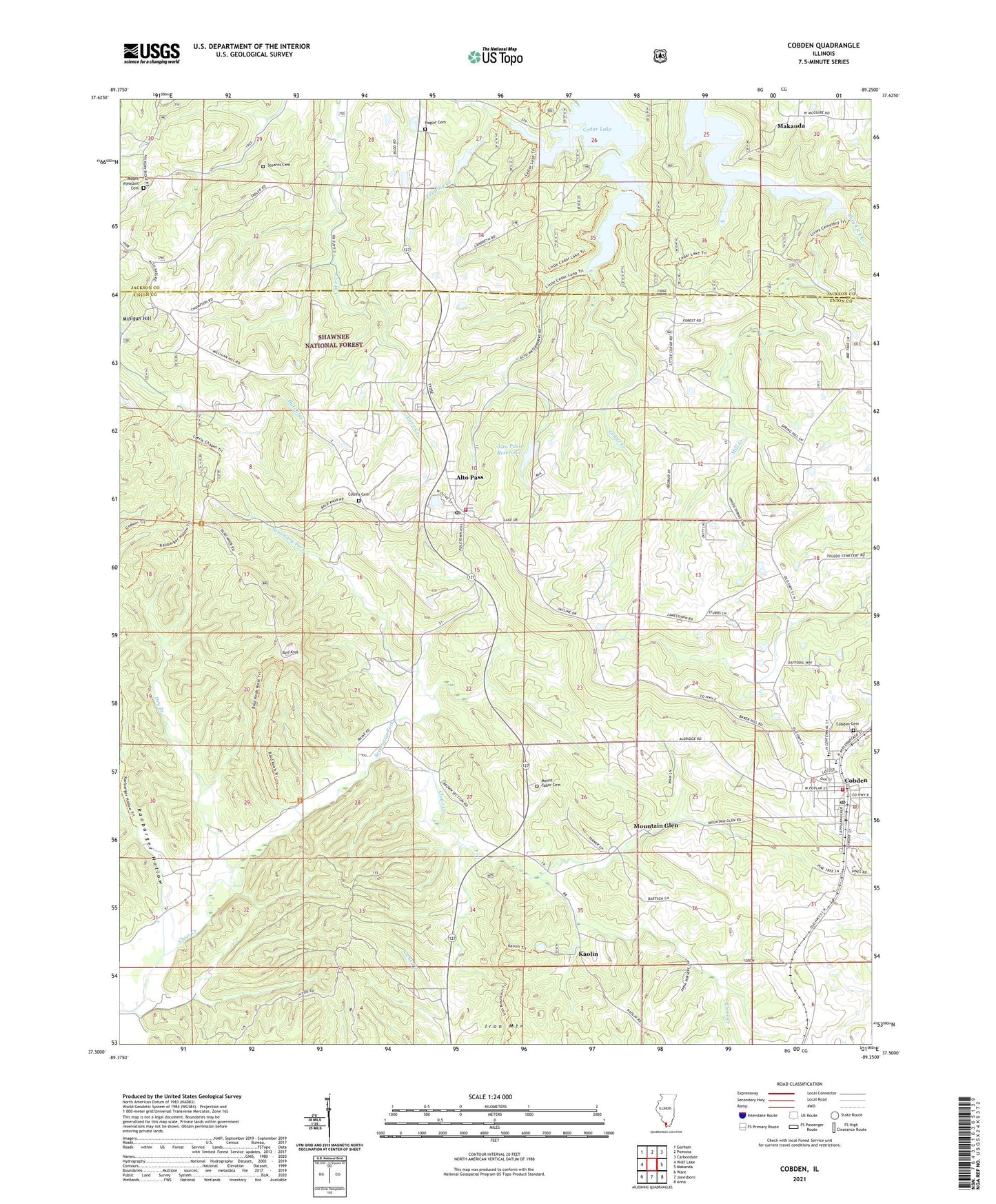
2024 topographic map quadrangle Cobden in the state of Illinois. Scale: 1:24000. Based on the newly updated USGS 7.5' US Topo map series, this map is in the following counties: Union, Jackson. The map contains contour data, water features, and other items you are used to seeing on USGS maps, but also has updated roads and other features. This is the next generation of topographic maps. Printed on high-quality waterproof paper with UV fade-resistant inks.
Quads adjacent to this one:
West: Wolf Lake
Northwest: Gorham
North: Pomona
Northeast: Carbondale
East: Makanda
Southeast: Anna
South: Jonesboro
Southwest: Ware
This map covers the same area as the classic USGS quad with code o37089e3.
Contains the following named places: Alto Pass, Alto Pass Election Precinct, Alto Pass Fire Department, Alto Pass Post Office, Alto Pass Reservoir, Alto Pass Reservoir Dam, Alto Vineyards, Bald Knob, Bald Knob Wilderness, Clay Lick Creek, Cobden, Cobden City Hall, Cobden District 2 Election Precinct, Cobden Elementary School, Cobden High School, Cobden Museum, Cobden Police Department, Cobden Post Office, Cobden Volunteer Fire Department, Collins Cemetery, Dry Branch, Gregory School, Hagler Cemetery, Hambric School, Iron Mountain, Jerusalem Church, Kaolin, Lamer School, Landreth School, Limestone Church, Lyerle Chapel, Mason, Mill Creek, Milligan Hill, Mount Pleasant Cemetery, Mount Pleasant Church, Mount Tabor Cemetery, Mountain Glen, Ranbarger Hollow, Rendleman School, Seminary Fork, Stearns Cemetery, Toledo Church, Topping Creek, Trail of Tears State Forest, Tunnel Hill School, Union Point School, Union Springs Church, Village of Alto Pass, Village of Cobden, Von Jakob Vineyard, Walnut Grove Church, ZIP Code: 62905