MyTopo
Greenup Illinois US Topo Map
Couldn't load pickup availability
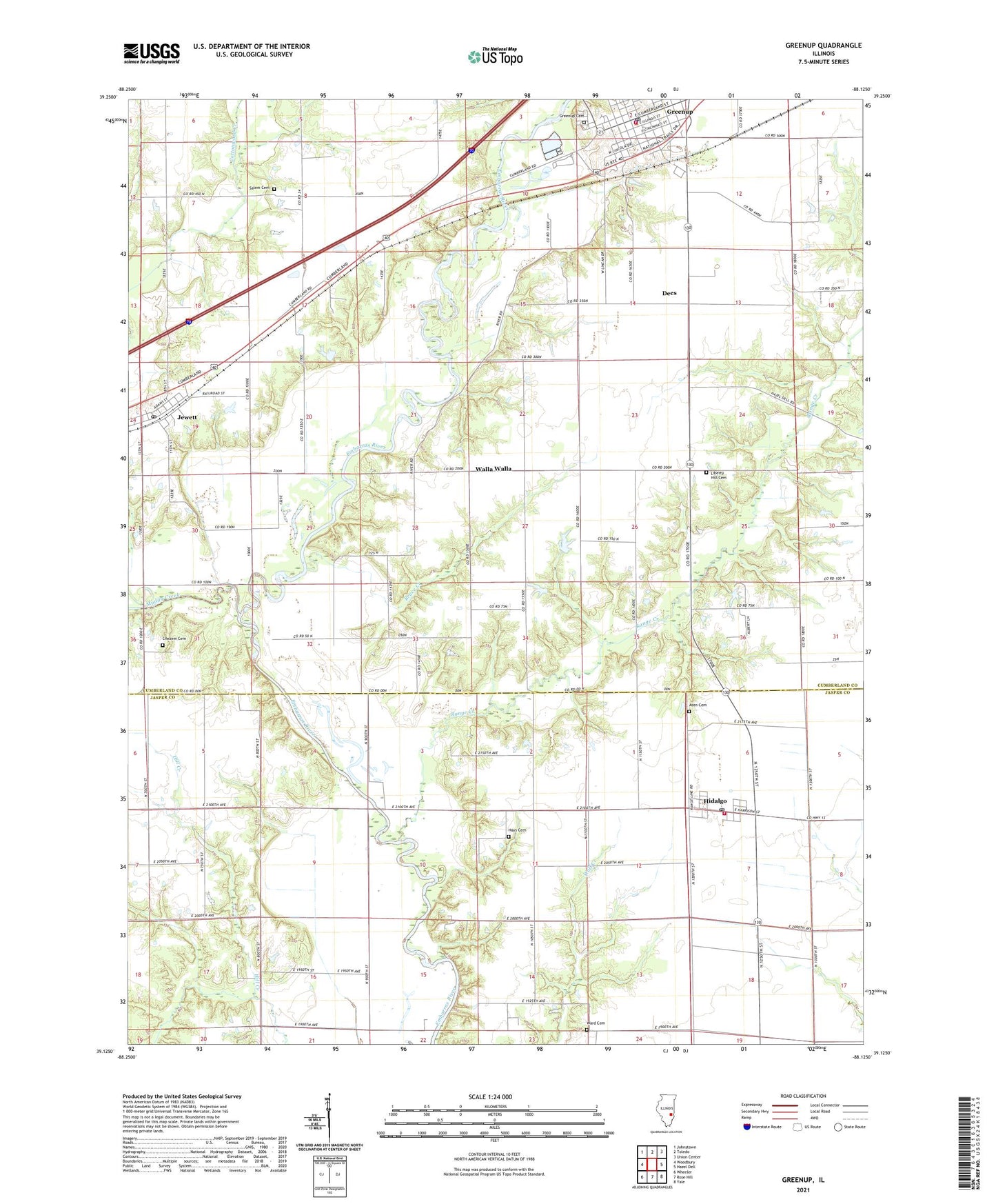
2024 topographic map quadrangle Greenup in the state of Illinois. Scale: 1:24000. Based on the newly updated USGS 7.5' US Topo map series, this map is in the following counties: Cumberland, Jasper. The map contains contour data, water features, and other items you are used to seeing on USGS maps, but also has updated roads and other features. This is the next generation of topographic maps. Printed on high-quality waterproof paper with UV fade-resistant inks.
Quads adjacent to this one:
West: Woodbury
Northwest: Johnstown
North: Toledo
Northeast: Union Center
East: Hazel Dell
Southeast: Yale
South: Rose Hill
Southwest: Wheeler
This map covers the same area as the classic USGS quad with code o39088b2.
Contains the following named places: Aten Cemetery, Bruce Creek, Cherwood Ford, Chezem Cemetery, Coad School, Crooked Creek Fire Protection District, Dees, Dewey School, Excelsior School, First Presbyterian Church, Frazier School, Greenup, Greenup Area Ambulance Service, Greenup Cemetery, Greenup Commercial Historic District, Greenup Fire Department, Greenup Police Department, Greenup Post Office, Greenup Township Carnegie Library, Hamilton School, Hayes Chapel, Hays Cemetery, Hickory School, Hidalgo, Hidalgo Elementary School, Hidalgo Post Office, Hutson School, Jewett, Jewett Community Church, Jewett Post Office, Layman's Seed Farm, Liberty Hill, Liberty Hill Cemetery, Liberty Hill School, Liberty Hill United Methodist Church, Muddy Creek, Range Creek, Salem Cemetery, Salem Church, Scotch Chapel School, Shull School, Spannagel Farms, Swick School, Township of Greenup, Village of Greenup, Village of Hidalgo, Village of Jewett, Walla Walla, Ward Cemetery, Weatherholt School, ZIP Code: 62432