MyTopo
Johnstown Illinois US Topo Map
Couldn't load pickup availability
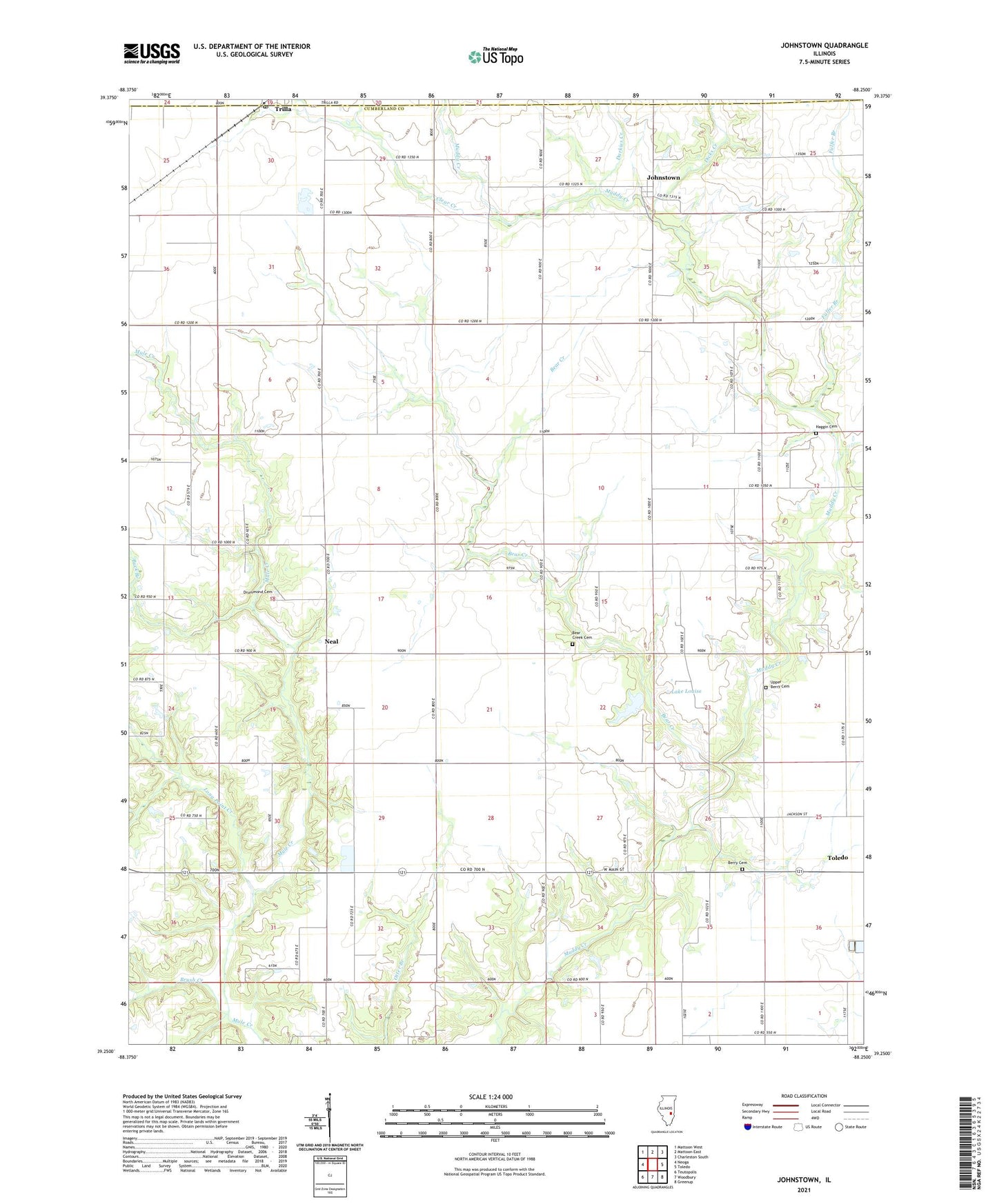
2024 topographic map quadrangle Johnstown in the state of Illinois. Scale: 1:24000. Based on the newly updated USGS 7.5' US Topo map series, this map is in the following counties: Cumberland, Coles. The map contains contour data, water features, and other items you are used to seeing on USGS maps, but also has updated roads and other features. This is the next generation of topographic maps. Printed on high-quality waterproof paper with UV fade-resistant inks.
Quads adjacent to this one:
West: Neoga
Northwest: Mattoon West
North: Mattoon East
Northeast: Charleston South
East: Toledo
Southeast: Greenup
South: Woodbury
Southwest: Teutopolis
This map covers the same area as the classic USGS quad with code o39088c3.
Contains the following named places: Bean School, Bear Creek, Bear Creek Cemetery, Berry Cemetery, Berry School, Brown School, Brush Creek, Buck Branch, Buck Branch School, Center School, Clear Creek, Cumberland Air Park RLA, Darkies Creek, Dicks Creek, Drummond Cemetery, Fair Play School, Folly Grove School, Fulfer Branch, Good Prospect Cumberland Presbyterian Church, Haggin Cemetery, Johnstown, King School, Lake Louise, Lake Louise Dam, Long Point Creek, Lookout School, Miller Creek, Mount Zion Baptist Church, Mule Creek Post Office, Neal, Shiloh Church, Silver Lake School, Thornton Airport, Township of Sumpter, Trilla Post Office, Union School, Upper Berry Cemetery, Whiteoak School, ZIP Codes: 62468, 62469