MyTopo
Greenview Illinois US Topo Map
Couldn't load pickup availability
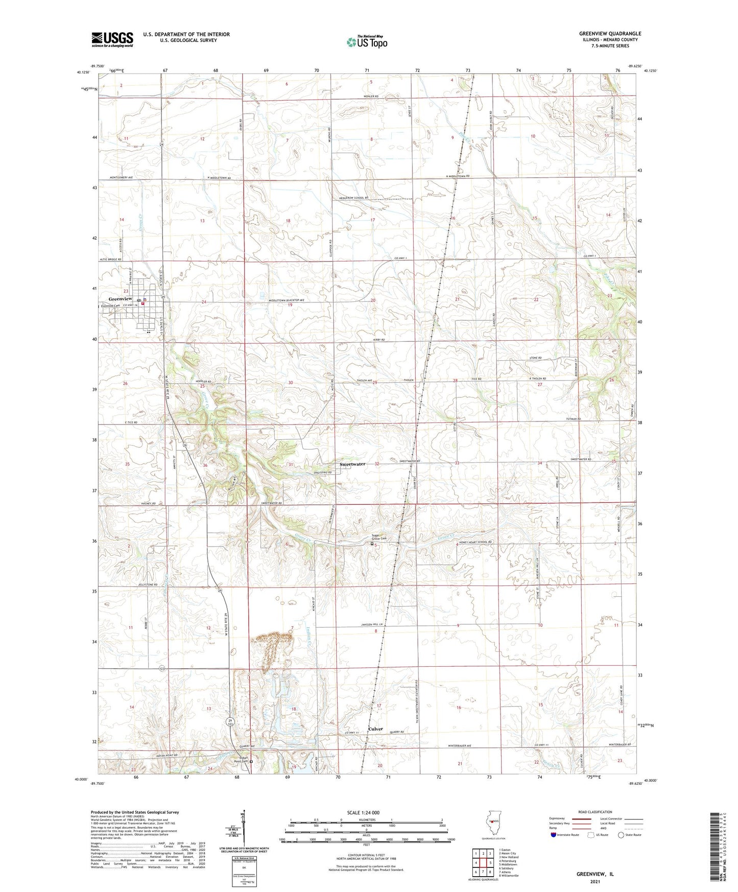
2024 topographic map quadrangle Greenview in the state of Illinois. Scale: 1:24000. Based on the newly updated USGS 7.5' US Topo map series, this map is in the following counties: Menard. The map contains contour data, water features, and other items you are used to seeing on USGS maps, but also has updated roads and other features. This is the next generation of topographic maps. Printed on high-quality waterproof paper with UV fade-resistant inks.
Quads adjacent to this one:
West: Petersburg
Northwest: Easton
North: Mason City
Northeast: New Holland
East: Middletown
Southeast: Williamsville
South: Athens
Southwest: Salisbury
This map covers the same area as the classic USGS quad with code o40089a6.
Contains the following named places: Bee Grove School, Culver, Douglas School, Greenview, Greenview Christian Church, Greenview Community Fire Protection District, Greenview Junior High School, Greenview Number 6 Election Precinct, Greenview Police Department, Greenview Post Office, Hedge Row School, Honey Heart School, Indian Point Cemetery, Indian Point Quarry, Indian Point School, Irish Grove Number 4 Election Precinct, North Sangamon United Presbyterian Church, Sugar Grove Cemetery, Sugar Grove Number 5 Election Precinct, Sweetwater, Village of Greenview, Walnut Row School, WLUJ-FM (Petersburg), ZIP Code: 62642