MyTopo
Middletown Illinois US Topo Map
Couldn't load pickup availability
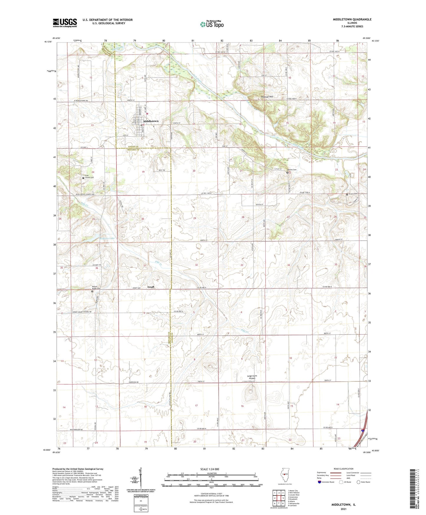
2024 topographic map quadrangle Middletown in the state of Illinois. Scale: 1:24000. Based on the newly updated USGS 7.5' US Topo map series, this map is in the following counties: Logan, Menard, Mason. The map contains contour data, water features, and other items you are used to seeing on USGS maps, but also has updated roads and other features. This is the next generation of topographic maps. Printed on high-quality waterproof paper with UV fade-resistant inks.
Quads adjacent to this one:
West: Greenview
Northwest: Mason City
North: New Holland
Northeast: Lincoln West
East: Broadwell
Southeast: Cornland
South: Williamsville
Southwest: Athens
This map covers the same area as the classic USGS quad with code o40089a5.
Contains the following named places: Barnes Cemetery, Barton - Sommers Woodland Nature Preserve, Croft, Elm Grove School, Evans Cemetery, Fancy Prairie Number 3 Election Precinct, Hopedale School, Irish Grove Cemetery, Irish Grove Presbyterian Church, Johnson Valley Mine, Leigh Farm Airport, Lynn Grove School, McMann Lake, McMann Lake Dam, Middletown, Middletown Fire Protection District, Middletown Post Office, Mill Grove School, New Holland-Middletown Middle School, Polecat Hill, Spring Bank School, Township of Corwin, Township of Hurlbut, Union School, Village of Middletown, Walnut Ridge Cemetery, ZIP Code: 62666