MyTopo
Grove City Illinois US Topo Map
Couldn't load pickup availability
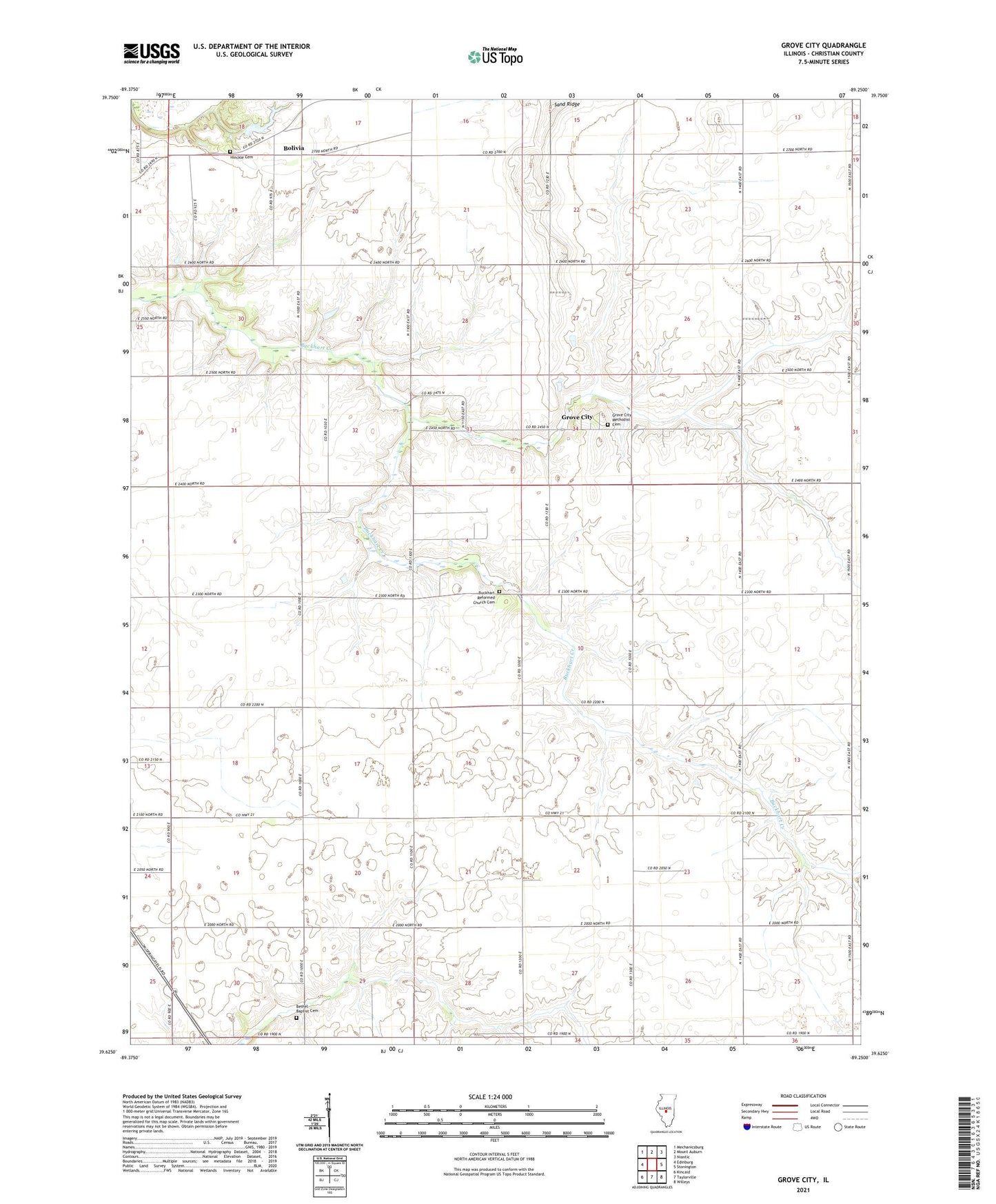
2024 topographic map quadrangle Grove City in the state of Illinois. Scale: 1:24000. Based on the newly updated USGS 7.5' US Topo map series, this map is in the following counties: Christian. The map contains contour data, water features, and other items you are used to seeing on USGS maps, but also has updated roads and other features. This is the next generation of topographic maps. Printed on high-quality waterproof paper with UV fade-resistant inks.
Quads adjacent to this one:
West: Edinburg
Northwest: Mechanicsburg
North: Mount Auburn
Northeast: Niantic
East: Stonington
Southeast: Willeys
South: Taylorville
Southwest: Kincaid
This map covers the same area as the classic USGS quad with code o39089f3.
Contains the following named places: Bethel Baptist Cemetery, Bethel Church, Blake School, Bolivia, Bolivia School, Buckhart Reformed Church Cemetery, Buckhart School, Central Point School, Cleveland School, Gardner School, Grove City, Grove City Methodist Cemetery, Hardy Airport, Hinckle Cemetery, Holben School, Illinois No Name Number 2030 Dam, Liberty Mosquito Church, Montgomery School, Mount Auburn Consolidated Oil Field, Perrine School, Prairie Lea School, Robinson Farm, Roby East Oil Field, Sand Ridge School, Sharpsburg School, Township of Buckhart, Township of Mount Auburn, Weiser School