MyTopo
Edinburg Illinois US Topo Map
Couldn't load pickup availability
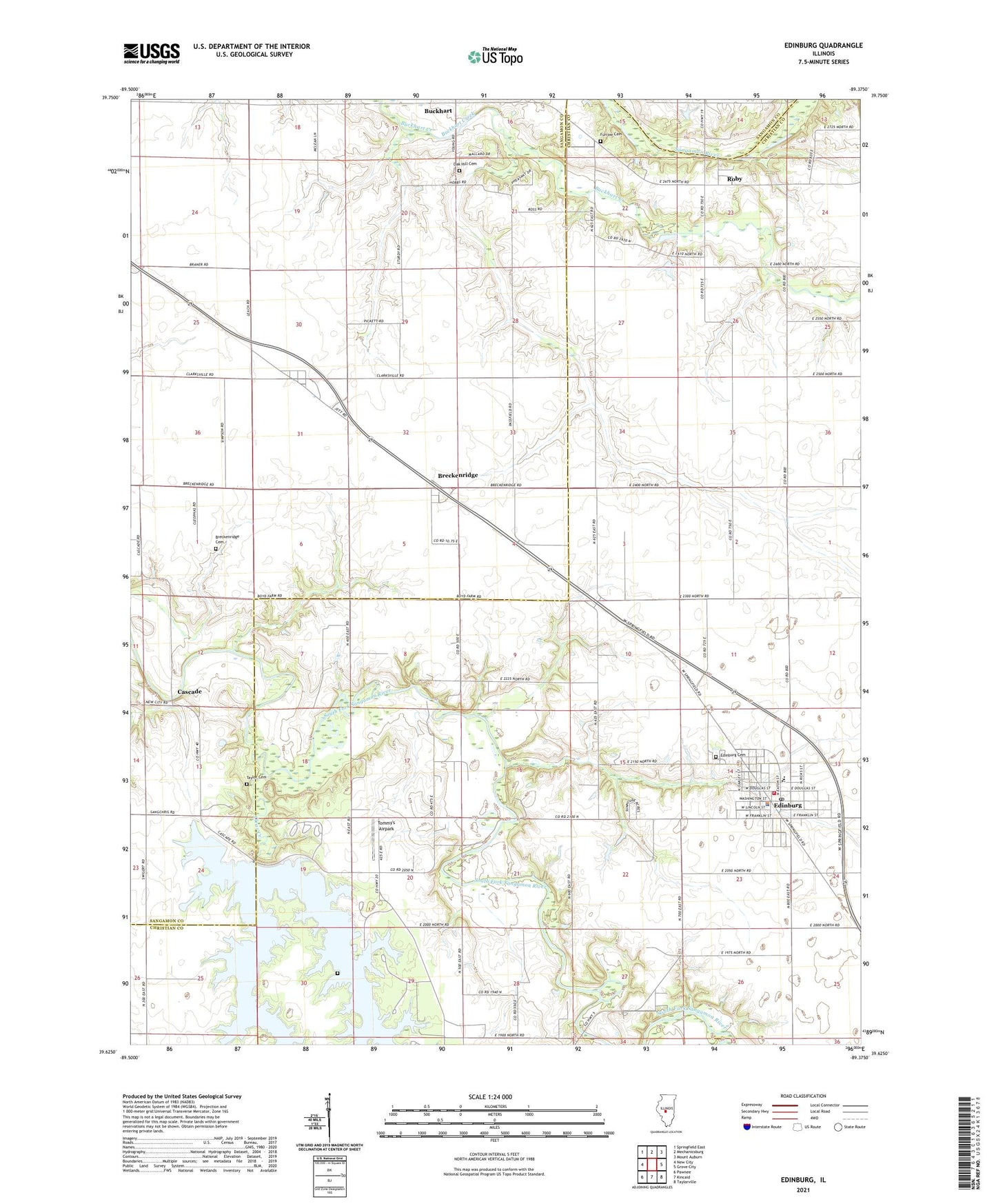
2024 topographic map quadrangle Edinburg in the state of Illinois. Scale: 1:24000. Based on the newly updated USGS 7.5' US Topo map series, this map is in the following counties: Christian, Sangamon. The map contains contour data, water features, and other items you are used to seeing on USGS maps, but also has updated roads and other features. This is the next generation of topographic maps. Printed on high-quality waterproof paper with UV fade-resistant inks.
Quads adjacent to this one:
West: New City
Northwest: Springfield East
North: Mechanicsburg
Northeast: Mount Auburn
East: Grove City
Southeast: Taylorville
South: Kincaid
Southwest: Pawnee
This map covers the same area as the classic USGS quad with code o39089f4.
Contains the following named places: American School, Berry, Berry Oil Field, Blueville, Breckenridge, Breckenridge Cemetery, Buckhart, Camelsburg School, Campbellsburg, Cascade, Cascade School, Clear Creek, Cooper School, Deer Run Campground, Edinburg, Edinburg Cemetery, Edinburg Fire Protection District, Edinburg High School, Edinburg Police Department, Edinburg Post Office, Edinburg West Oil Field, Finley Cemetery, Furrow Cemetery, George School, Greenwood School, Greer School, Harts Park, Hickory Point Campground, Hundley Airport, Liberty School, Martin School, Oak Hill Cemetery, Pheasant Run Access Area, Roby, Roby Post Office, Sangchris Lake Dam, Sangchris Lake State Park, Star School, Sudduth School, Taft Airport, Taylor Cemetery, Tommy's Airpark, Township of Cooper, Village of Edinburg, ZIP Codes: 62531, 62563