MyTopo
Hahnaman Illinois US Topo Map
Couldn't load pickup availability
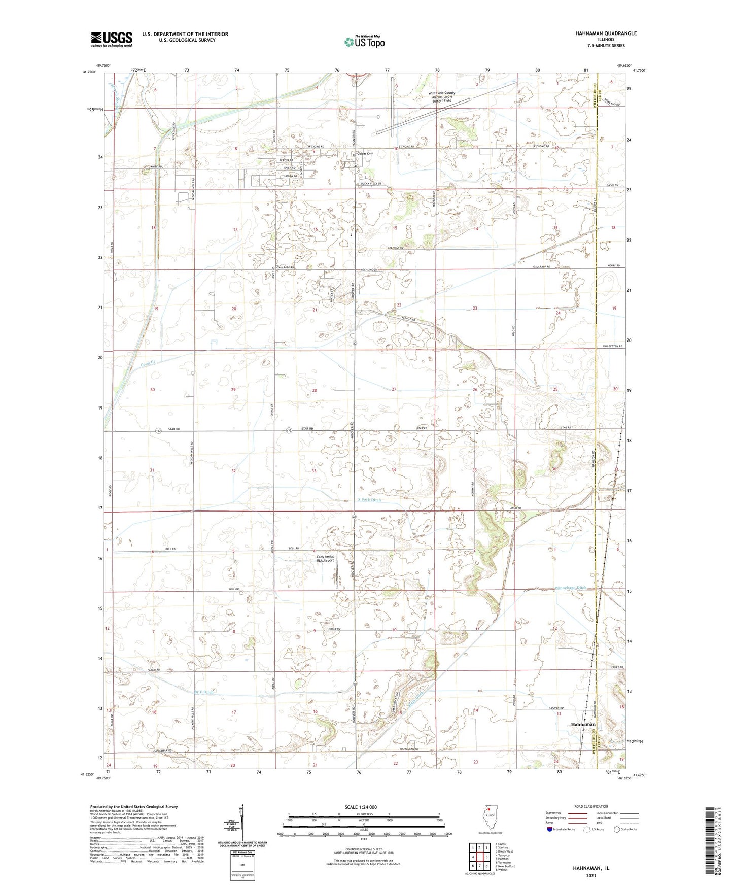
2024 topographic map quadrangle Hahnaman in the state of Illinois. Scale: 1:24000. Based on the newly updated USGS 7.5' US Topo map series, this map is in the following counties: Whiteside, Lee. The map contains contour data, water features, and other items you are used to seeing on USGS maps, but also has updated roads and other features. This is the next generation of topographic maps. Printed on high-quality waterproof paper with UV fade-resistant inks.
Quads adjacent to this one:
West: Tampico
Northwest: Como
North: Sterling
Northeast: Dixon West
East: Harmon
Southeast: Walnut
South: New Bedford
Southwest: Yorktown
This map covers the same area as the classic USGS quad with code o41089f6.
Contains the following named places: Advance School, Allpress School, Bane School, Branch F Ditch, Cady Aerial RLA Airport, Champion School, East Hume School, Elmendorf School, Excelsior School, Foley Sand Prairie Nature Preserve, Golder Cemetery, Goose Lake, Hahnaman, Island School, McWhorter School, Montmorency School, Shrock Feedlot, South Fork Ditch, Stores, Sturtz School, Swan Lake School, Township of Hahnaman, Township of Montmorency, Whiteside County Airport-Jos H Bittorf Field, Winnebago Ditch, ZIP Code: 61071