MyTopo
Harmon Illinois US Topo Map
Couldn't load pickup availability
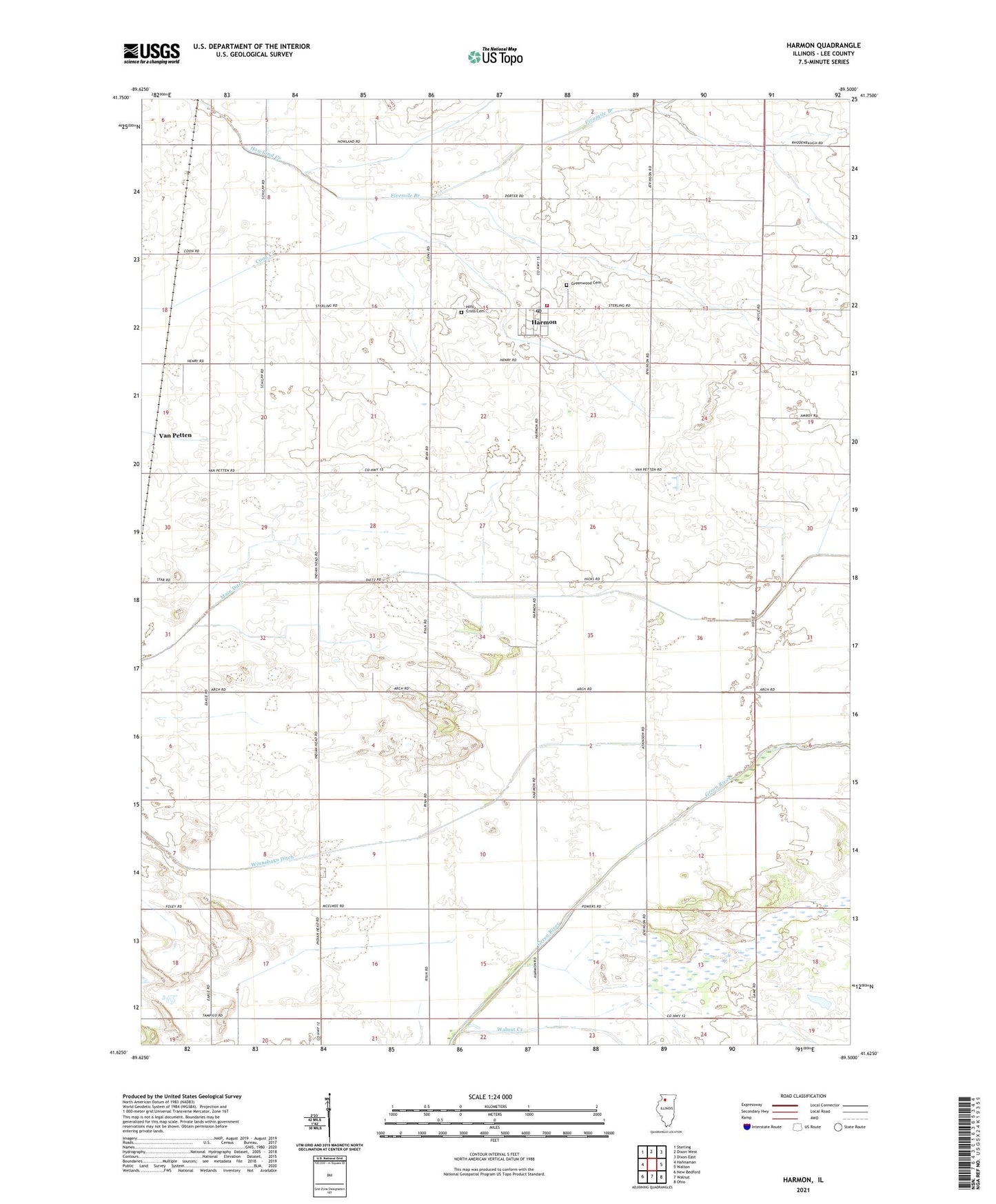
2024 topographic map quadrangle Harmon in the state of Illinois. Scale: 1:24000. Based on the newly updated USGS 7.5' US Topo map series, this map is in the following counties: Lee. The map contains contour data, water features, and other items you are used to seeing on USGS maps, but also has updated roads and other features. This is the next generation of topographic maps. Printed on high-quality waterproof paper with UV fade-resistant inks.
Quads adjacent to this one:
West: Hahnaman
Northwest: Sterling
North: Dixon West
Northeast: Dixon East
East: Walton
Southeast: Ohio
South: Walnut
Southwest: New Bedford
This map covers the same area as the classic USGS quad with code o41089f5.
Contains the following named places: Carbough School, Coon Creek Ditch, Daven School, Five Mile Branch Ditch, Fivemile Branch, Green River State Wildlife Management Area, Greenwood Cemetery, Harmon, Harmon Fire Department, Harmon Post Office, Harmon United Methodist Church, Holy Cross Cemetery, Lake School, Lyon School, Main Ditch, Manion School, Meckell School, Merchant School, Saint Flannen Catholic Church, Township of Hamilton, Township of Harmon, Van Petten, Village of Harmon, ZIP Code: 61042