MyTopo
Pleasant Dale Valley Illinois US Topo Map
Couldn't load pickup availability
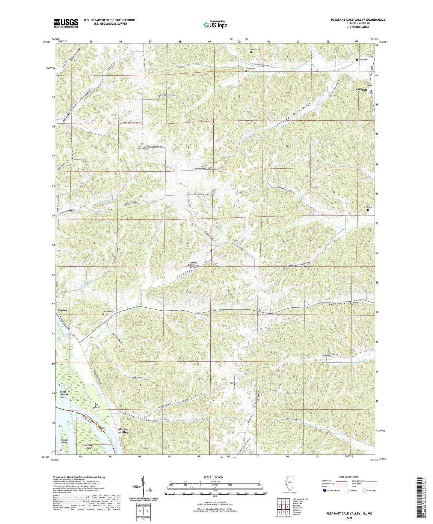
2024 topographic map quadrangle Pleasant Dale Valley in the states of Illinois, Missouri. Scale: 1:24000. Based on the newly updated USGS 7.5' US Topo map series, this map is in the following counties: Calhoun, Pike. The map contains contour data, water features, and other items you are used to seeing on USGS maps, but also has updated roads and other features. This is the next generation of topographic maps. Printed on high-quality waterproof paper with UV fade-resistant inks.
Quads adjacent to this one:
West: Annada
Northwest: Pleasant Hill East
North: Pearl West
Northeast: Pearl East
East: Kampsville
Southeast: Hardin
South: Hamburg
Southwest: Elsberry
Contains the following named places: Carlin Election Precinct, Church of the Nazarene Camp, Cliffdale, Crater Election Precinct, Dog Island, Fox Creek, Fox Creek Cemetery, Fox Creek School, Hamburg Election Precinct, Herrens Bess Hollow Airfield, Hillcrest Cemetery, Hillcrest Church, Hillcrest School, Howard Island, Mozier, Mozier Hollow, Mozier Hollow School, Mozier Landing, Pancake Hollow, Panther Creek School, Pleasant Dale Church, Pleasant Dale School, Pleasant Dale Valley, Retzer Cemetery, Silver Creek Cemetery, Silver Creek School, Smith Cemetery, Spear Cemetery, Summit Grove Church, Summit Grove School, The Sny, Village Green School, West Panther Creek School, ZIP Codes: 62045, 62053, 62070